Bima Sultanate
Videos
The Sultanate of Bima, officially known as The Settlements and Lands of Mbojo, alternatively the Kingdom of Bima, was a Muslim state in the eastern part of Sumbawa in Indonesia, at the site of the pre

Greatest extent of the Bima Kingdom era at its Peak in the 15th Century under the Leadership of Tureli Manggampo Bilmana.

Mbangga Mbaru Lambang Kesultanan Bima

The Nggusu Waru (Octagon) flag of the Bima Kingdom, Siwa-Buda (Hindu-Budha) era.

The Main Distribution Area of the Mbojo Tribe and the Ncuhi Mbojo Area (Ancient Bima) before being divided into East Bima and West Bima (Dompu) in the 13th/14th century.
Sumba
Videos
Sumba, natively also spelt as Humba, Hubba, Suba, or Zuba is an Indonesian island located in the Eastern Indonesia and administratively part of the East Nusa Tenggara provincial territory. Sumba has a

Native women of Sumba wearing the traditional Sumba clothing in Kanangar district of East Sumba, c. 1900s.

The Hinggi, typical cultural woven cloth of native Sumba men depicts the Sumba mythological creatures.

The governmental seal of Dutch colonization at Watuhadang of Umalulu district in East Sumba.
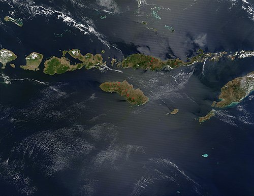
August 2003 NASA satellite photograph of the Lesser Sunda Islands; Sumba is in the bottom centre