Bogoslof Island or Agasagook Island is the summit of a submarine stratovolcano at the south edge of the Bering Sea, 35 miles (56 km) northwest of Unalaska Island of the Aleutian Islands chain. It has a land area of 319.3 acres (1.292 km2) and is uninhabited. It is 1,040 meters (3,410 ft) long and 1,512 m (4,961 ft) wide, with a peak elevation of 490 feet (150 m). The stratovolcano rises about 6,000 ft (1,800 m) from the seabed, but the summit is the only part that projects above sea level. The island is believed to be relatively new, with the volcano being entirely below sea level before 1796, and most of the presently 300-acre island being formed by eruptions since 1900.
Aerial view, looking south (1994)
Boiling mud, August 2018
A tufted puffin on Bogoslof Island
A fur seal colony on Bogoslof Island
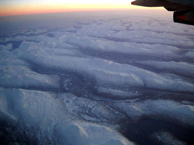
The Aleutian Islands —also called the Aleut Islands, Aleutic Islands, or, before 1867, the Catherine Archipelago—are a chain of 14 main, larger volcanic islands and 55 smaller ones. Most of the Aleutian Islands belong to the U.S. state of Alaska, with the archipelago encompassing the Aleutians West Census Area and the Aleutians East Borough. The Commander Islands, located further to the west, belong to the Russian federal subject of Kamchatka Krai, of the Russian Far East. The islands form part of the Aleutian Arc of the Northern Pacific Ocean, and occupy a land area of 6,821 sq mi (17,666 km2) that extends westward roughly 1,200 mi (1,900 km) from the Alaskan Peninsula mainland, in the direction of the Kamchatka Peninsula; the archipelago acts as a border between the Bering Sea to the north and the Pacific Ocean to the south. Crossing longitude 180°, at which point east and west longitude end, the archipelago contains both the westernmost and easternmost parts of the United States, by longitude. The westernmost U.S. island, in real terms, however, is Attu Island, west of which runs the International Date Line. While nearly all of the archipelago is part of Alaska at the extreme western end, the small, geologically-related Commander Islands belong to Russia.

Unalaska Island in the Aleutian Islands.
The Aleutian Islands from 32,000 feet (9,700 m).
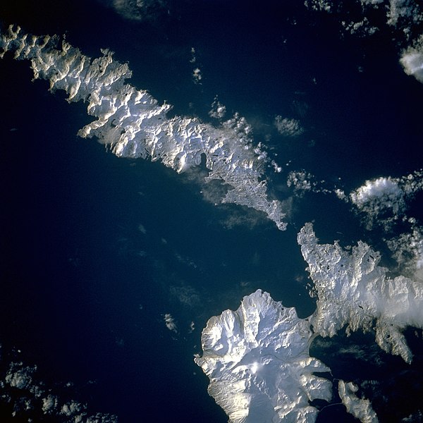
Image of the islands taken by the STS-56 crew. Amlia Island is visible in the upper left of the photo, while the eastern half of Atka Island is shown at the right. North is to the bottom left in this photo.
These cloud formations were seen over the western Aleutian Islands.