A border barrier, border fence or border wall is a separation barrier that runs along or near an international border. Such barriers are typically constructed for border control purposes such as curbing illegal immigration, human trafficking, and smuggling. Some such barriers are constructed for defence or security reasons. In cases of a disputed or unclear border, erecting a barrier can serve as a de facto unilateral consolidation of a territorial claim that can supersede formal delimitation. A border barrier does not usually indicate the location of the actual border, and is usually constructed unilaterally by a country, without the agreement or cooperation of the other country.
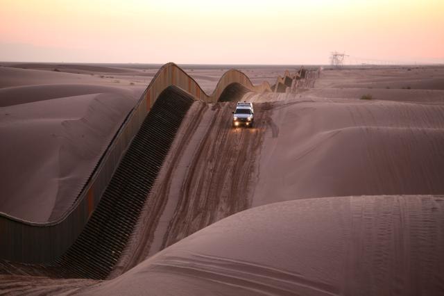
Mexico–United States barrier in California
Israeli West Bank barrier
Berlin Wall, 1988.
A separation barrier or separation wall is a barrier, wall or fence, constructed to limit the movement of people across a certain line or border, or to separate peoples or cultures. A separation barrier that runs along an internationally recognized border is known as a border barrier.
The Berlin Wall divided Berlin from 1961 until 1989, and was demolished between 1990 and 1992.
Green Line separation barrier, Cyprus
Rafah Border Crossing
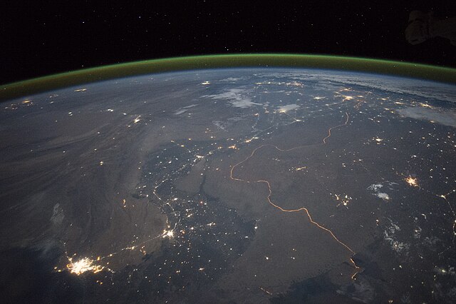
The India-Pakistan border seen at night