Brisbane Water National Park
Brisbane Water National Park is a national park on the Central Coast of New South Wales, Australia. The national park is situated 70 kilometres (43 mi) north of Sydney and 12 kilometres (7.5 mi) southwest of Gosford. It consists the Brisbane Water and Mooney Mooney Creek waterways.
Waterfall in the deeper areas of the Brisbane Water National Park.
Natural Swimming hole in Brisbane Water National Park
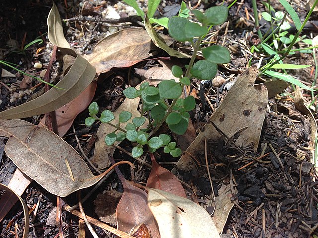
Somersby mintbush
Swift Parrot (Lathamus discolor)
Brisbane Water is a wave-dominated barrier estuary located in the Central Coast region of New South Wales, Australia. Brisbane Water has its origin at the confluence of the Narara and Coorumbine Creeks, to the south–east of Gosford and travels for approximately 18 kilometres (11 mi) in a southerly direction to its mouth at Broken Bay, about 7 kilometres (4.3 mi) from the Tasman Sea, at Barrenjoey Head. A number of towns and suburbs surround the shores of Brisbane Water, including Blackwall, Booker Bay, Davistown, Empire Bay, Erina, Ettalong Beach, Gosford, Green Point, Hardys Bay, Kilcare, Kincumber, Koolewong, Phegans Bay, Point Frederick, Point Clare, Saratoga, Tascott, Wagstaffe, and Woy Woy. Contained within Brisbane Water is St Huberts Island, Rileys Island, Dunmar Island and Pelican Island; and adjoining the estuary is Brisbane Water National Park to the west and Bouddi National Park to the east. Forming part of the same tidal estuary system is a separate but connected basin, the Kincumber Broadwater, lying to the east of Davistown.

Brisbane Water


