An Bun Beag, meaning "the small river mouth", is a small Gaeltacht village and townland in County Donegal, Ireland. It is officially the smallest townland in Gaoth Dobhair (Gweedore), but today the name Bunbeg is used to describe a large region of the parish. It is situated between Derrybeg and the townland of Dore and is home to many of Gweedore's amenities and businesses. The Clady River flows into the Crolly River beside Bunbeg Quay, on the south-western outskirts of Bunbeg.
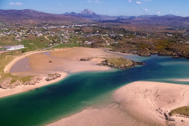
Bunbeg with Errigal in the background and the wrecked Cara Na Mara (Friend of the Sea) on the tidal sandbanks of Magheraclogher Strand. Better known locally as Bád Eddie (Eddie's Boat), it ran ashore due to rough seas in the early 1970s.
Óstan Gaoth Dobhair in 2011.
Aerial view of Óstán Gaoth Dobhair, Magheraclogher beach, bád eddie and some of the surrounding area.
Bád Eddie in 2011
Gweedore is a Gaeltacht (Irish-speaking) district and parish located on the Atlantic coast of County Donegal in the north-west of Ireland. Gweedore stretches some 26 kilometres (16 mi) from Glasserchoo and Bloody Foreland in the north to Crolly in the south and around 14 kilometres (9 mi) from Dunlewey in the east to Magheraclogher and Magheralosk in the west, and is sometimes described as one of Europe's most densely populated rural areas. It is the largest Irish-speaking parish in Ireland with a population of around 4,065, and is also the home of the northwest regional studios of the Irish-language radio service RTÉ Raidió na Gaeltachta, as well as an external campus of the University of Galway. Gweedore includes the settlements of Brinlack, Bunbeg, Derrybeg, Crolly and Dunlewey, and sits in the shade of County Donegal's highest peak, Errigal.
An aerial view of Gweedore, with Errigal and Magheraclogher Beach
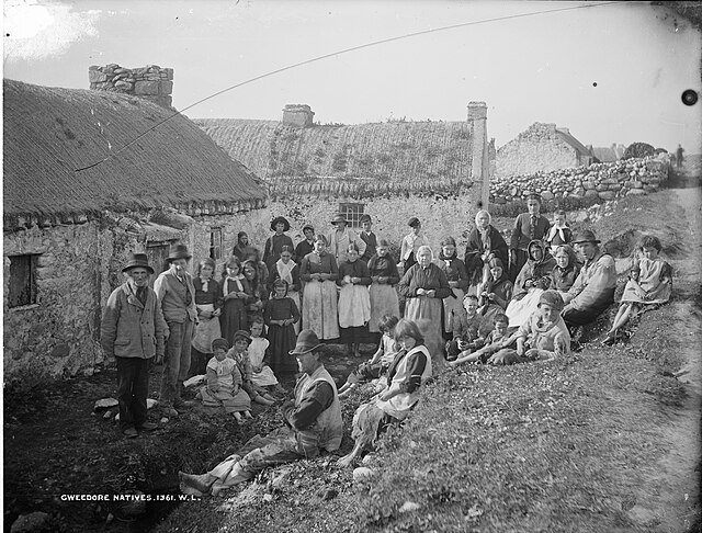
Gweedore natives pictured here in Magheraclogher in 1865
Men fishing with Errigal in the background
A view of Gweedore from Bloody Foreland


