Caldera de Taburiente National Park
Caldera de Taburiente National Park is a national park on the island of La Palma, Canary Islands, Spain. It contains the Caldera de Taburiente, which dominates the northern part of the island, and was designated as a national park in 1954. The telescopes of the Roque de los Muchachos Observatory are situated very close to the summit.
Outer view of the caldera rim
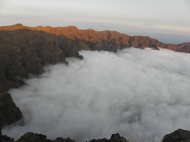
Clouds covering a part of the caldera
Looking from the edge of the caldera into a tributary valley
Pinus canariensis, Caldera de Taburiente
La Palma, also known as La isla bonita and historically San Miguel de La Palma, is the most northwesterly island of the Canary Islands, Spain, which is a Spanish autonomous community and archipelago in Macaronesia in the North Atlantic Ocean. La Palma has an area of 708.32 square kilometres (273.48 sq mi) making it the fifth largest of the eight main Canary Islands. The total population at the start of 2023 was 84,338, of which 15,522 lived in the capital, Santa Cruz de La Palma and 20,375 in Los Llanos de Aridane. Its highest mountain is the Roque de los Muchachos, at 2,426 metres (7,959 ft), being second among the peaks of the Canaries after the Teide massif on Tenerife.
Satellite view of La Palma
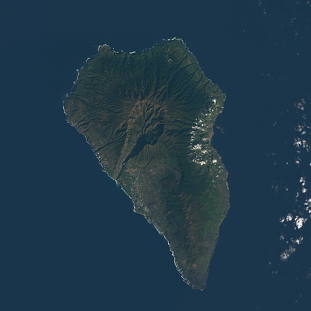
Satellite image of La Palma, with the Caldera de Taburiente visible (north is to the lower right)
Crater of San Antonio volcano (last erupted 1677)
A view of the island looking south