Camaderry at 699 metres (2,293 ft), is the 90th-highest peak in Ireland on the Arderin scale, and the 112th-highest peak on the Vandeleur-Lynam scale. Camaderry is situated in the southern sector of the Wicklow Mountains range, and forms a broad horseshoe around the valley of Glendalough with the hydroelectric station at Turlough Hill 681 metres (2,234 ft), and the mountains of Conavalla 734 metres (2,408 ft), and Lugduff 652 metres (2,139 ft). Camaderry has a subsidiary summit, Camaderry South East Top 677 metres (2,221 ft), and both lie across the deep Wicklow Gap from Tonelagee 817 metres (2,680 ft), which sits on the "central spine" of the Wicklow range.
Camaderry (right) at Glendalough Upper Lake
Summit cairn
South face from Luggala
Camaderry (right)
Lists of mountains in Ireland
In these lists of mountains in Ireland, those within Northern Ireland, or on the Republic of Ireland – United Kingdom border, are marked with an asterisk, while the rest are within the Republic of Ireland. Where mountains are ranked by height, the definition of the topographical prominence used to classify the mountain, is noted. In British definitions, a height of 600 metres (1,969 ft) is required for a mountain, whereas in Ireland, a lower threshold of 500 metres (1,640 ft) is sometimes advocated.
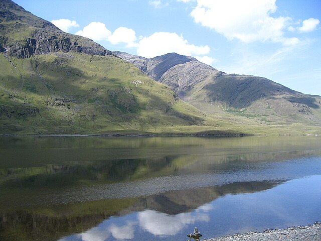
Mweelrea from Doo Lough in Connemara. Mweelrea is the highest Provincial Top in Connacht, the highest County Top in Mayo, the 5th highest Irish P600 mountain, the 14th highest Irish Marilyn mountain, the 16th highest Irish MountainViews mountain, the 26th highest Irish Arderin/Hewitt mountain, and the 34th highest Irish Vandeleur-Lynam/Nuttall mountain. It is not a Furth (or Irish Munro), and therefore not a Real Munro.