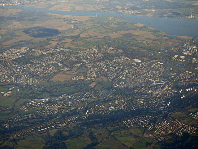
Camelon is a large settlement within the Falkirk council area, Scotland. The village is in the Forth Valley, 1.3 miles (2.1 km) west of Falkirk, 1.3 miles (2.1 km) south of Larbert and 2.6 miles (4.2 km) east of Bonnybridge. The main road through Camelon is the A803 road which links the village to Falkirk. At the time of the 2001 census, Camelon had a population of 4,508.
Camelon swing bridge over the Forth and Clyde Canal at Camelon lock.
War Memorial – opened 23 April 2016
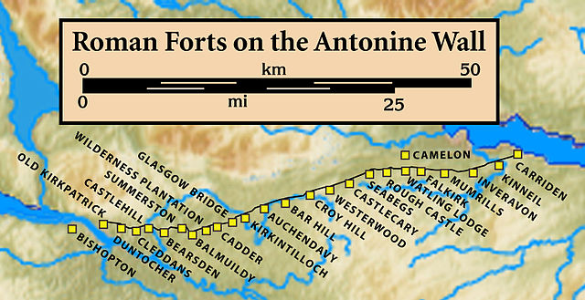
Forts and Fortlets associated with the Antonine Wall from west to east: Bishopton, Old Kilpatrick, Duntocher, Cleddans, Castlehill, Bearsden, Summerston, Balmuildy, Wilderness Plantation, Cadder, Glasgow Bridge, Kirkintilloch, Auchendavy, Bar Hill, Croy Hill, Westerwood, Castlecary, Seabegs, Rough Castle, Camelon, Watling Lodge, Falkirk, Mumrills, Inveravon, Kinneil, Carriden
The Union Inn, named for the Union Canal, reflected in the canal
Falkirk is a town in the Central Lowlands of Scotland, historically within the county of Stirlingshire. It lies in the Forth Valley, 23+1⁄2 miles northwest of Edinburgh and 20+1⁄2 miles (33 km) northeast of Glasgow.
Falkirk High Street
Forts and Fortlets associated with the Antonine Wall from west to east: Bishopton, Old Kilpatrick, Duntocher, Cleddans, Castlehill, Bearsden, Summerston, Balmuildy, Wilderness Plantation, Cadder, Glasgow Bridge, Kirkintilloch, Auchendavy, Bar Hill, Croy Hill, Westerwood, Castlecary, Seabegs, Rough Castle, Camelon, Watling Lodge, Falkirk, Mumrills, Inveravon, Kinneil, Carriden
Romans (Antonine Guard Living History Society) saluting at Callendar House
Falkirk and Stenhousemuir