Cantabrian Mountains
Videos
The Cantabrian Mountains or Cantabrian Range are one of the main systems of mountain ranges in Spain.
They stretch for over 300 km (180 miles) across northern Spain, from the western limit of the Pyrenees to the Galician Massif in Galicia, along the coast of the Cantabrian Sea. Their easternmost end meets the Sistema Ibérico.

Cantabrian Mountains parallel to the Cantabrian Sea seen from Castro Valnera in an east-west direction. In the background, the Montaña Palentina (left) and the Picos de Europa (right)

Torre de Cerredo (2,650 m.), the highest summit of the Cantabrian Mountains

Pico Espigüete (2,450 m.)
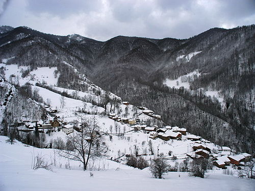
Typical Cantabrian Mountains landscape in winter
Pyrenees
Videos
The Pyrenees are a mountain range straddling the border of France and Spain. They extend nearly 500 km (310 mi) from their union with the Cantabrian Mountains to Cap de Creus on the Mediterranean coast, reaching a maximum altitude of 3,404 metres (11,168 ft) at the peak of Aneto.

Central Pyrenees

Composite satellite image of the Pyrenees (NASA)

Pico de Aneto, the highest mountain of the Pyrenees, Aragon (Spain)

Pic de Bugatet in the Néouvielle massif