Cantino planisphere
Videos
The Cantino planisphere or Cantino world map is a manuscript Portuguese world map preserved at the Biblioteca Estense in Modena, Italy. It is named after Alberto Cantino, an agent for the Duke of Ferr
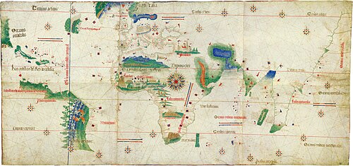
Cantino planisphere (1502), Biblioteca Estense, Modena, Italy

Major wind rose of the Cantino planisphere

The Treaty of Tordesillas line

The rhumb-line construction scheme and geographic lines in the Cantino planisphere. Adapted from Gaspar (2012), Plate 3
Portuguese maritime explorations resulted in numerous territories and maritime routes recorded by the Portuguese on journeys during the 15th and 16th centuries. Portuguese sailors were at the vanguard
Cantino planisphere
…successfully smuggled it from Portugal to Italy in 1502. It measures 220 cm × 105 cm (87 in × 41 in). The planisphere is the earliest surviving map showing Portuguese geographic discoveries in the east and west and is particularly notable for portraying a fragmentary record of the Brazilian coast, which the Portuguese explorer Pedro Álvares…

The Cantino planisphere, made by an anonymous cartographer in 1502, shows the world as it was understood by Europeans after their great explorations at the end of the fifteenth century.
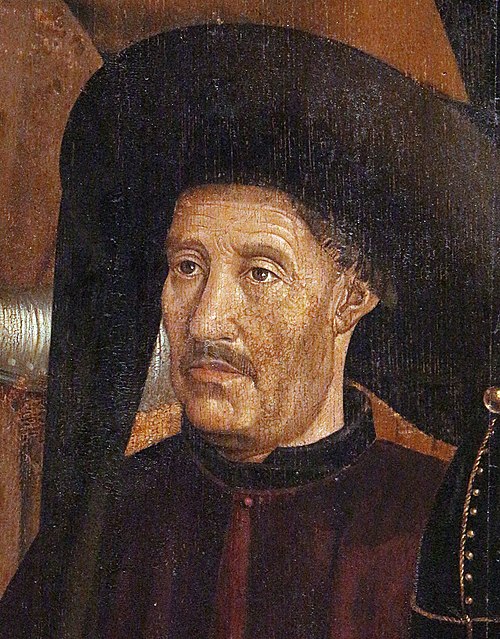
Prince Henry the Navigator, generally credited as the driving force behind Portuguese maritime exploration.

The caravel was an existing ship type that was prominent in Portuguese exploration from about 1440

An illustration of the padrão Diogo Cão erected at Cape St. Mary, Angola.