Cape Hatteras
Videos
Cape Hatteras is a cape located at a pronounced bend in Hatteras Island, one of the barrier islands of North Carolina.
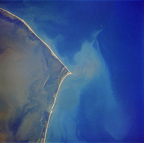
Cape Hatteras from space, October 1989. Image orientated with North to the left and East pointing up.

An aerial view of where Hurricane Isabel cut inlets into Hatteras Island

The Cape Hatteras Life Guard Station, which later became part of the Durant Motel, and was upended by Hurricane Isabel in 2003
Bermuda
Videos
Bermuda is a British Overseas Territory in the North Atlantic Ocean. The closest land outside the territory is in the American state of North Carolina, about 1,035 km (643 mi) to the west-northwest.


Bermuda Gazette of 12 November 1796, calling for privateering against Spain and its allies; it has advertisements for crew for two privateer vessels.

Mullet Bay and the harbour at St. George's, the original capital

Hamilton Harbour in the mid-1920s