A carbonate platform is a sedimentary body which possesses topographic relief, and is composed of autochthonic calcareous deposits. Platform growth is mediated by sessile organisms whose skeletons build up the reef or by organisms which induce carbonate precipitation through their metabolism. Therefore, carbonate platforms can not grow up everywhere: they are not present in places where limiting factors to the life of reef-building organisms exist. Such limiting factors are, among others: light, water temperature, transparency and pH-Value. For example, carbonate sedimentation along the Atlantic South American coasts takes place everywhere but at the mouth of the Amazon River, because of the intense turbidity of the water there. Spectacular examples of present-day carbonate platforms are the Bahama Banks under which the platform is roughly 8 km thick, the Yucatan Peninsula which is up to 2 km thick, the Florida platform, the platform on which the Great Barrier Reef is growing, and the Maldive atolls. All these carbonate platforms and their associated reefs are confined to tropical latitudes. Today's reefs are built mainly by scleractinian corals, but in the distant past other organisms, like archaeocyatha or extinct cnidaria were important reef builders.

The Bahama Banks are an example of a carbonate platform
An example of carbonate mud sedimentation in the internal part of the Florida Bay lagoon. The presence of young mangroves is important to entrap the carbonate mud.
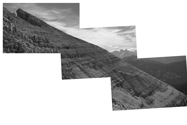
The Cimon del Latemar (Rotzo Formation, Trento province, Dolomites, northern Italy) represents the internal lagoon of a fossil carbonate platform. Continuous sedimentation took place in an environment as the one described in the image of the Florida Bay and, given a strong subsidence, led to the formation of a sedimentary series that therefore acquired considerable thickness.
Aganane Formation platform of Morocco with first order autocyclic regressive cycles
The Atlantic Ocean is the second-largest of the world's five oceans, with an area of about 85,133,000 km2 (32,870,000 sq mi). It covers approximately 17% of Earth's surface and about 24% of its water surface area. During the Age of Discovery, it was known for separating the New World of the Americas from the Old World of Afro-Eurasia.
As the Gulf Stream meanders across the North Atlantic from the North American east coast to Western Europe its temperature drops by 20 °C (36 °F).
Path of the thermohaline circulation. Purple paths represent deep-water currents, while blue paths represent surface currents.
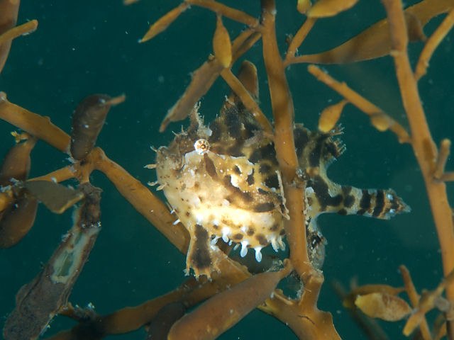
Sargassum fish (Histrio histrio)
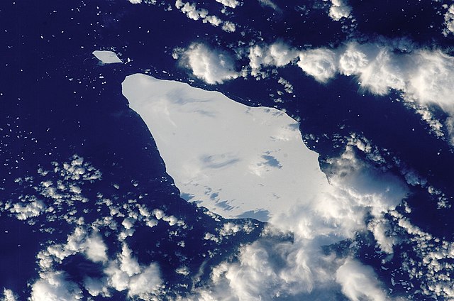
Iceberg A22A in the South Atlantic Ocean