Cascade Range
Videos
The Cascade Range, or Cascades, is a major mountain range of western North America, extending from southern British Columbia through Washington and Oregon to Northern California. It includes both non-

The Cascades in Washington, with Mount Rainier, the range's highest mountain, standing at 14,411 ft (4,392 m). Seen in the background (left to right) are Mount Adams, Mount Hood, and Mount St. Helens.

The Columbia Gorge marks where the Columbia River splits the Cascade Range between the states of Washington and Oregon.

West side view of Mount Shuksan in summer as seen from Artist Point in Washington.

Mount Hood is the tallest point in the U.S. state of Oregon.
Mount St. Helens
Videos
Mount St. Helens is an active stratovolcano located in Skamania County, Washington, in the Pacific Northwest region of the United States. It lies 52 miles northeast of Portland, Oregon, and 98 miles s
Cascade Range
…Oregon), "M'laiksini Yaina" for Mount McLoughlin, "Tahoma", the Lushootseed name for Mount Rainier, and "Louwala-Clough", meaning "smoking mountain" for Mount St. Helens. In early 1792, British navigator George Vancouver explored Puget Sound and gave English names to the high mountains he saw. Mount Baker was named for…

3,000 ft (900 m) high steam plume on May 19, 1982, two years and a day after the 1980 major eruption that created the visible gap on the north side of the mountain
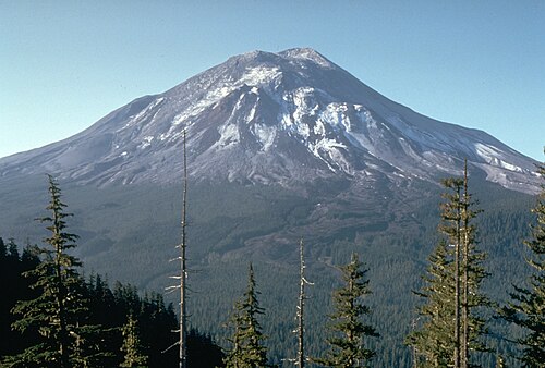
Mount St. Helens pictured the day before the 1980 eruption, which removed much of the northern face of the mountain, leaving a large crater

Aerial view with Mount Adams in background

East Dome on the east flank of Mount St. Helens in 2013.