The Cederberg mountains are located near Clanwilliam, approximately 300 km north of Cape Town, South Africa at about 32°30′S 19°0′E. The mountain range is named after the endangered Clanwilliam cedar, which is a tree endemic to the area. The mountains are noted for dramatic rock formations and San rock art. The Cederberg Wilderness Area is administered by CapeNature.
Sneeuberg, the highest peak in the Cederberg, with the Maltese Cross in the foreground.
Schematic diagram of an approximate 100 km west–east (left to right) geological cross-section through the Cederberg (a portion of the Cape Fold Belt to which Table Mountain on the Cape Peninsula also belongs). The rocky layers (in different colours) belong to the Cape Supergroup. The green layer is the Pakhuis Formation (a sediment, called "tillite", left by glaciers which for a short time crossed this area about 450 million years ago). It divides the Peninsula Formation Sandstone (or
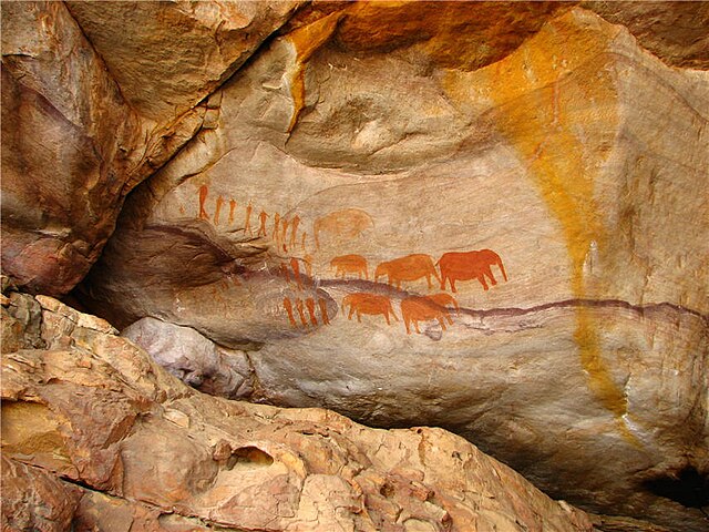
San rock art near Stadsaal Cave, Matjiesrivier Nature Reserve in the Cederberg
Rock pool in a river in the Cederberg Conservancy
Clanwilliam, South Africa
Clanwilliam is a town in the Olifants River valley in the Western Cape, South Africa, about 200 kilometres (120 mi) north of Cape Town. It is located in, and the seat of, the Cederberg Local Municipality. As of 2011 Clanwilliam had a population of 7,674.
Image: Old Gaol, Clanwilliam
Image: Sevilla Rock Art 9
Image: Ou NG kerk Clanwilliam
Image: Clanwilliam, Western Cape MAGISTERIAL DISTRICT GENERAL