Chaitén (volcano)
Videos
Chaitén is a volcanic caldera 3 kilometres in diameter, 17 kilometres west of the elongated ice-capped Michinmahuida volcano and 10 kilometres northeast of the town of Chaitén, near the Gulf of Corcov
2003 photograph from the International Space Station. The caldera is the circular feature visible in the lower part of the image. The town of Chaitén is to the top. (This image is aligned roughly southwest, around 220°.)

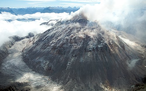
Image of the rhyolitic lava dome of Chaitén Volcano during its 2008–2010 eruption.

Image of the ash cloud from 2008 eruption stretching into San Jorge Basin in the Atlantic Ocean. MODIS, 2008-05-03.

The Chaitén Volcano seen from a commercial flight, October 2008.
Corcovado Volcano
Videos
Corcovado Volcano is a stratovolcano located about 25 kilometres south of the mouth of the Yelcho River, in the Palena Province, Los Lagos Region, Chile. The glacially eroded volcano is flanked by Hol

The volcano seen from the west on a commercial flight.

The volcano as seen from Quellón