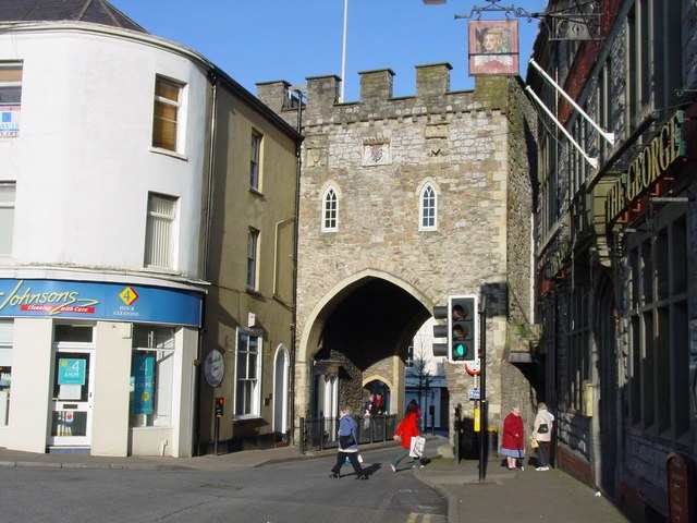
The Port Wall in Chepstow, Monmouthshire, Wales, is a late thirteenth century stone wall, which was constructed for the twin purposes of defence and tax collection by permitting users of the town's market only one point of access through the wall at the Town Gate. The wall originally formed a semi-circle extending for some 1,100 metres (3,600 ft), roughly southwards from Chepstow Castle to the River Wye. It enclosed an area of 53 hectares, including the entire town and port as it existed at that time. Substantial sections of the wall remain intact, and both the Port Wall and the Town Gate are Grade I listed buildings. The Port Wall is a Scheduled monument.
Part of the Port Wall, Chepstow, showing an information board prepared by the Chepstow Society
Part of the Port Wall
Section through the wall showing its rubble construction
Chepstow is a town and community in Monmouthshire, Wales, adjoining the border with Gloucestershire, England. It is located on the tidal River Wye, about 2 miles (3 km) above its confluence with the River Severn, and adjoining the western end of the Severn Bridge. It is the easternmost settlement in Wales, situated 16 miles (26 km) east of Newport, 28 miles (45 km) east-northeast of Cardiff, 18 miles (29 km) northwest of Bristol and 110 miles (180 km) west of London.
Chepstow Castle and 1816 road bridge across the River Wye, seen from Tutshill
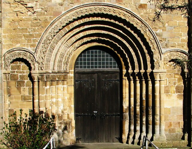
Norman doorway of St Mary's Priory Church
Chepstow Town Gate, originally dating from the late 13th century, rebuilt in the 16th century and later restored
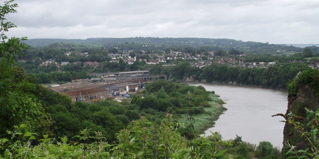
View towards the site of the former National Shipyard No.1, in the area covered by the factory buildings and overgrown slipways in the centre of the photograph