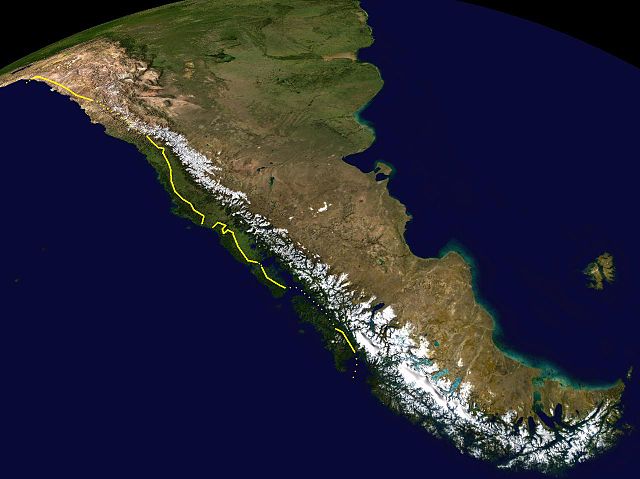
The Chilean Coastal Range is a mountain range that runs from north to south along the Pacific coast of South America parallel to the Andean Mountains, extending from Morro de Arica in the north to Taitao Peninsula, where it ends at the Chile Triple Junction, in the south. The range has a strong influence on the climate of Chile since it produces a rain shadow to the east. Because of this the vegetation growing on the seaward slopes is much more exuberant than in the interior. Compared to the coastal lowlands and the Intermediate Depression, it is sparsely populated with land use varying from protected areas to grazing and silviculture. The range is present in all Chilean regions, except for Coquimbo Region and Magallanes Region.
View from Cerro Oncol
The eastern border of the Chilean Coast Range is marked with yellow. Uncertain borders are marked with dots.
Cerro Armazones, home of the E-ELT, is located in the Sierra Vicuña Mackenna.
The climate of Chile comprises a wide range of weather conditions across a large geographic scale, extending across 38 degrees in latitude, making generalizations difficult. According to the Köppen system, Chile within its borders hosts at least seven major climatic subtypes, ranging from low desert in the north, to alpine tundra and glaciers in the east and southeast, tropical rainforest in Easter Island, Oceanic in the south and Mediterranean climate in central Chile. There are four seasons in most of the country: summer, autumn, winter, and spring.
Prevailing winds, sea currents and stationary cyclones near Chile
View toward the interior of Easter Island
Pan de Azúcar National Park in Atacama Desert
Maritime influence makes some southern Andean valleys prone to snowfalls in winter such as in Curarrehue in the picture.


