A city block, residential block, urban block, or simply block is a central element of urban planning and urban design.
A one-square-kilometre superblock sector in Milton Keynes framed by major roads on a grid configuration. The road network within the sector uses dead-end streets complemented by bike and foot paths which connect the entire sector and beyond.
A diagramatic illustration of the streets (blue), paths (green) and open spaces (yellow) in a "Pedestrian Pocket" superblock (after P. Calthorpe and D. Kelbaugh)
Stuyvesant Town road and path network plan showing the looped streets and the connecting paths through the open space. It is an example of the superblock concept and of the idea of "filtered permeability."
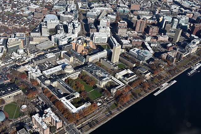
The campus of the Massachusetts Institute of Technology is located on superblocks of urban Cambridge, Massachusetts
In real estate, a Land lot or plot of land is a tract or parcel of land owned or meant to be owned by some owner(s). A plot is essentially considered a parcel of real property in some countries or immovable property in other countries. Possible owners of a plot can be one or more persons or another legal entity, such as a company, corporation, organization, government, or trust. A common form of ownership of a plot is called fee simple in some countries.
Vacant lot, with fencing
A marker to show the divisions of individual lots within a subdivision.


