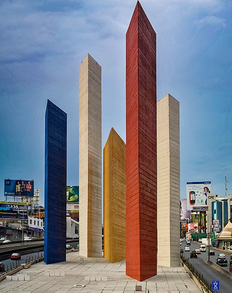
Ciudad Satélite, commonly known as Satélite, is an upper-middle and upper-class neighborhood located 14 KM northwest of Mexico City's Historic Center, in Naucalpan, in the western part of Greater Mexico City. Officially, the name corresponds exclusively to the homonym neighbourhood, Ciudad Satélite, founded circa 1957. But over time, its surrounding area—including upper-middle class neighbourhoods like Lomas Verdes, Echegaray, Paseos del Bosque or San Mateo, alongside adjacent municipalities Atizapán de Zaragoza and Tlalnepantla de Baz—has also become collectively known as "Satélite", due to its prominence as both an economically and socially dynamic area.
Torres de Satélite landmark
Torres de Satélite in 1957
Naucalpan, officially Naucalpan de Juárez, is one of 125 municipalities located just northwest of Mexico City in the adjoining State of Mexico. The municipal seat is the city of Naucalpan de Juárez, which extends into the neighboring municipality of Huixquilucan.
Torres de Satélite sculpture in Ciudad Satélite, a neighborhood in Naucalpan
Cd. Satellite middle class colonia
Landscape of Mexico City seen from Pedregal de Echegaray
Part of the Anillo Pereferico