Cleveland Street, London
Videos
Photos
Cleveland Street in central London runs north to south from Euston Road (A501) to the junction of Mortimer Street and Goodge Street. It lies within Fitzrovia, in the W1 post code area. Cleveland Street also runs along part of the border between Bloomsbury (ward) which is located in London Borough of Camden, and West End (ward) in the City of Westminster. In the 17th century, the way was known as the Green Lane, when the area was still rural, or Wrastling Lane, after a nearby amphitheatre for boxing and wrestling.

A view of Cleveland Street looking south from the intersection with Greenwell Street (previously Buckingham Street), featuring the BT Tower

Area before Cleveland Street (Norfolk St) was laid out in 1774

Cleveland Street Work House London

Cleveland Street Conservation Area
Fitzrovia
Videos
Photos
Fitzrovia is a district of central London, England, near the West End. The eastern part of the area is in the London Borough of Camden, and the western in the City of Westminster. It has its roots in the Manor of Tottenham Court, and was urbanised in the 18th century. Its name was coined in the late 1930s by Tom Driberg.

Charlotte Place, near the border of Camden and Westminster, with the area's main landmark, the BT Tower, visible in the background
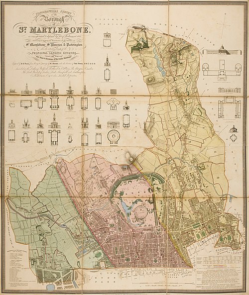
The Ancient Parishes of – west to east – Paddington and St Marylebone (in the modern City of Westminster), and St Pancras (in the modern London Borough of Camden). The core area of Fitzrovia (Tottenham Court), is the south-western part of St Pancras; the remainder of Fitzrovia is in south-eastern St Marylebone.

The Fitzroy Tavern may have given its name to Fitzrovia

The south-west part of the parish of St Pancras in 1804. The core of the area later known as Fitzrovia. The north is to the right-hand side.