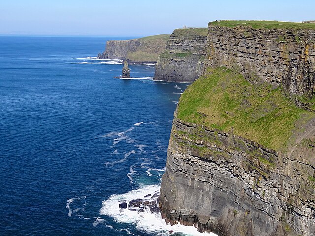
The Cliffs of Moher are sea cliffs located at the southwestern edge of the Burren region in County Clare, Ireland. They run for about 14 kilometres. At their southern end, they rise 120 metres (390 ft) above the Atlantic Ocean at Hag's Head, and, 8 kilometres to the north, they reach their maximum height of 214 metres (702 ft) just north of O'Brien's Tower, a round stone tower near the midpoint of the cliffs, built in 1835 by Sir Cornelius O'Brien, then continue at lower heights. The closest settlements are the villages of Liscannor 6 km to the south, and Doolin 7 km to the north.
Looking north towards O'Brien's Tower
A 19th-century Photochrom postcard of the cliffs, with Leacmayornagneeve rock in the foreground
Visitor centre
The cliffs seen from the beach
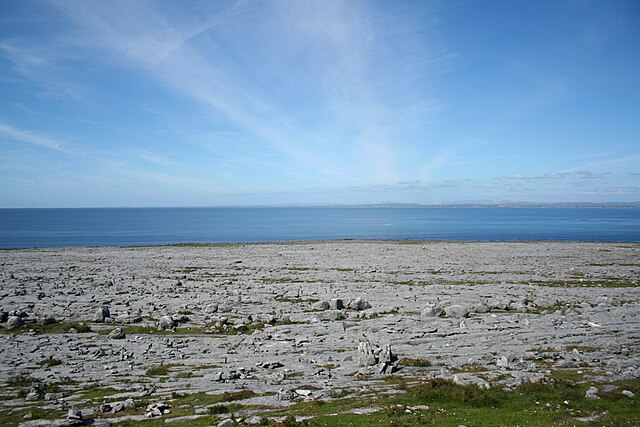
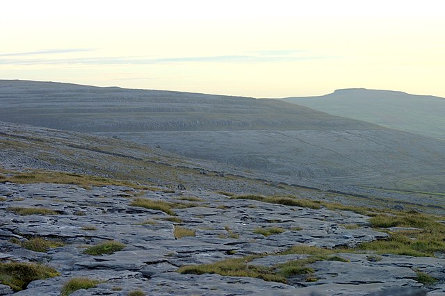
The Burren is a karst/glaciokarst landscape centred in County Clare, on the west coast of Ireland. It measures around 530 square kilometres (200 sq mi), within the circle made by the villages of Lisdoonvarna, Corofin, Gort and Kinvara. The area includes such natural features as Mullaghmore hill and Ailladie cliffs, and historic monuments such as Poulnabrone dolmen and Caherconnell Stone Fort.
The Burren National Park covers a small part of the Burren and is the smallest of the six National Parks in Ireland, while the adjacent territory, including the Cliffs of Moher, is included in the Burren and Cliffs of Moher Geopark.
The karst landscape of the Burren
Stark contrast between The Burren and the surrounding landscape
Mullaghmore Hill
The karst hills of The Burren