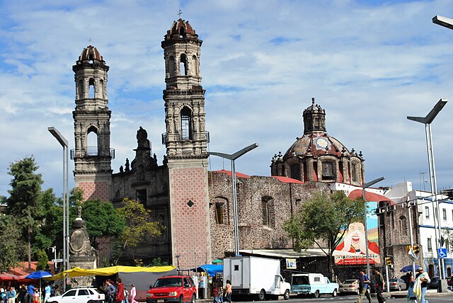
Colonia Guerrero is a colonia of Mexico City located just north-northwest of the historic center. Its borders are formed by Ricardo Flores Magón to the north, Eje Central Lazaro Cardenas and Paseo de la Reforma to the east, Eje1 Poniente Guerrero to the west and Avenida Hidalgo to the south. The colonia has a long history, beginning as an indigenous neighborhood in the colonial period called Cuepopan. The origins of the modern colonia begin in the first half of the 19th century, but most of its development occurred as a residential area in the late 19th and early 20th. Over the 20th century, several rail lines and major arteries were built through here, changing its character Cuauhtémoc borough. It is home to two early colonial era churches, the Franz Mayer Museum and one Neo-Gothic church from the Porfirian era.
Santa Veracruz Church on Av. Hidalgo
View of the San Hipolito Church
Paseo de la Reforma is a wide avenue that runs diagonally across the heart of Mexico City. It was designed at the behest of Emperor Maximilian by Ferdinand von Rosenzweig during the era of the Second Mexican Empire and modeled after the great boulevards of Europe, such as the Ringstraße in Vienna and the Champs-Élysées in Paris. The planned grand avenue was to link the National Palace with the imperial residence, Chapultepec Castle, which was then on the southwestern edge of town. The project was originally named Paseo de la Emperatriz in honor of Maximilian's consort Empress Carlota. After the fall of the Empire and Maximilian's subsequent execution, the Restored Republic renamed the Paseo in honor of the La Reforma.
Paseo de la Reforma as seen from Chapultepec Castle
Paseo de la Reforma skyline
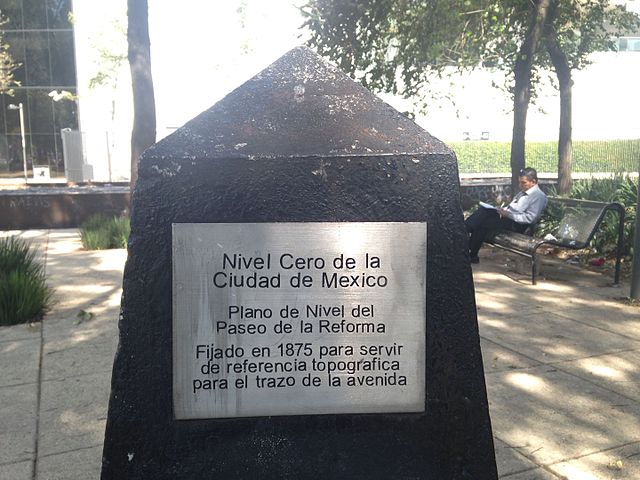
Nivel cero de la Ciudad de México, topographic monument 1875, to mark the path of the Paseo.
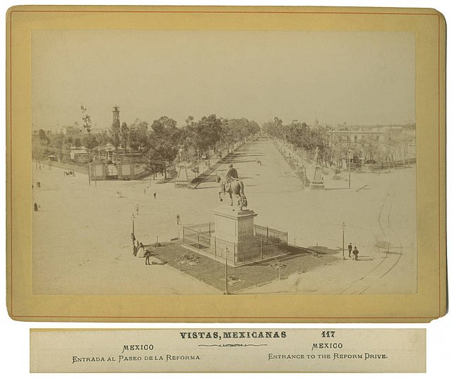
Ornate King Charles IV of Spain statue of the Paseo de la Reforma in the 19th century.


