Commander Islands
Videos
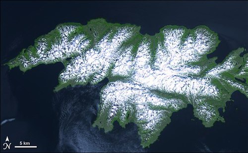
The Commander Islands, Komandorski Islands, or Komandorskie Islands are a series of islands in the Russian Far East, a part of the Aleutian Islands, located about 175 km (109 mi) east of the Kamchatka Peninsula in the Bering Sea. Treeless and sparsely populated, the islands consist of Bering Island, Medny Island and fifteen islets and rocks. The largest of the latter are Tufted Puffin Rock (Kamen Toporkov or Ostrov Toporkov), 15 ha, and Kamen Ariy, which are between 3 km (1.9 mi) and 13 km (8.1 mi) west of the only settlement, Nikolskoye. Administratively, the Commanders compose the Aleutsky District of the Kamchatka Krai in Russia.

The village of Nikolskoye on Bering Island

Medny Island

Bering Island

Group of Aleut hunters from Bering Island (c. 1884–1886)
Attu Island
Videos
Attu is an island in the Near Islands. It is the westernmost point of the U.S. state of Alaska. The island became uninhabited in 2010, making it the largest uninhabited island that is part of the United States politically.
Attu Island

Attu village in June 1937

U.S. troops negotiate snow and ice during the Battle of Attu in May 1943
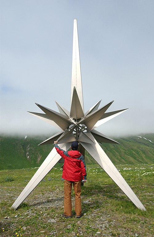
The Second World War peace memorial on Attu Island