Coulee
Videos
Coulee, or coulée is a term applied rather loosely to different landforms, all of which refer to a kind of valley or drainage zone. The word coulee comes from the Canadian French coulée, from French couler 'to flow'.

This side canyon of Grand Coulee in Washington was carved by the Missoula floods.

A view through a coulee in Alberta, with steep but lower sides, and water in the bottom.
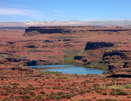
Drumheller Channels in the Columbia Basin of Washington

A view upward into a coulee in the Oldman River valley in Lethbridge, Alberta
La Crosse, Wisconsin
Videos
La Crosse is a city in and the county seat of La Crosse County, Wisconsin, United States. Positioned alongside the Mississippi River, La Crosse is the largest city on Wisconsin's western border. La Crosse's population was 52,680 as of the 2020 census. The city forms the core of the La Crosse–Onalaska metropolitan area, which includes all of La Crosse County and Houston County, Minnesota, with a population of 139,627.
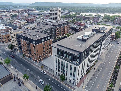
Downtown La Crosse

Artist representation of La Crosse (1867).

Pearl Street in Downtown La Crosse in the summer of 1939.

Downtown Historic District