Country Hills Boulevard
Videos
Page
Country Hills Boulevard is a major expressway in Calgary, Alberta. It is notably one of the longest east-west routes in Calgary and one few routes north of 16 Avenue N that is mostly continuous from the west end of the city to the east end. East of Calgary, Country Hills Boulevard continues as Alberta Highway 564. West of Calgary, it continues as Hamilton Drive as it passes through the Bearspaw Country Club. Country Hills Boulevard was originally named 112 Avenue N, and was a rural road in northeastern Calgary, but was renamed in the early 1990s when its namesake community of Country Hills, as well as Harvest Hills and Coventry Hills, were constructed. Throughout the 1990s, the roadway was constructed in segments in northwest Calgary, departing from the original road allowance to follow the area's hilly topography.

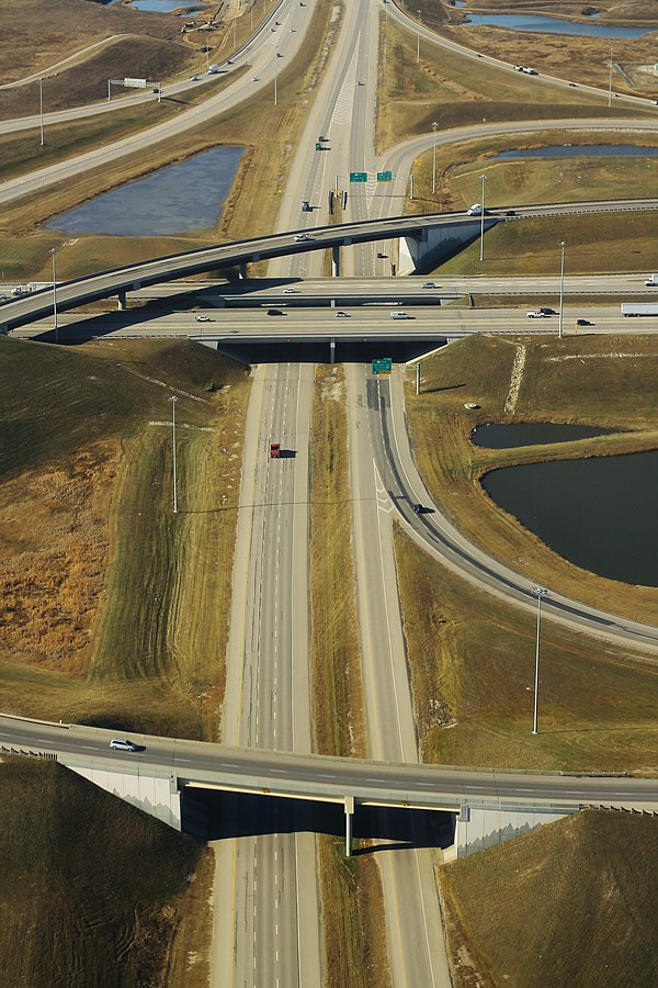
Country Hills Boulevard and Beddington Trail intersecting in the lower part of the photo
Deerfoot Trail
Videos
Page
Deerfoot Trail is a 46.4-kilometre (28.8 mi) freeway segment of Highway 2 in Calgary, Alberta, Canada. It stretches the entire length of the city from south to north and links suburbs to downtown via Memorial Drive and 17 Avenue SE. The freeway begins south of Calgary where it splits from Macleod Trail, crosses the Bow River into city limits, and reaches the Stoney Trail ring road. Crisscrossing twice more with the river, it intersects Glenmore Trail and Memorial Drive; the former is a major east–west expressway while the latter is a freeway spur into downtown. In north Calgary, it crosses Highway 1 and passes Calgary International Airport before ending at a second interchange with Stoney Trail. Highway 2 becomes the Queen Elizabeth II Highway as it continues north into Rocky View County towards Red Deer and Edmonton.
Looking west on Stoney Trail NE at its interchange with Deerfoot Trail
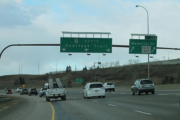
Northbound Deerfoot Trail curving at Memorial Drive and the Northeast Line of the CTrain. The interchange was constructed as part of the second Deerfoot segment that opened in 1975, and the CTrain bridges were constructed in 2000.

Partial cloverleaf interchange at 17 Avenue SE in south Calgary

The ramp from westbound Peigan Trail to southbound Deerfoot Trail was modified in 2009 to loop back upon itself, allowing for a greater merge distance before crossing Ogden Road and the Bow River