Crescent Hill, Louisville
Crescent Hill is a neighborhood four miles (6 km) east of downtown Louisville, Kentucky USA. This area was originally called "Beargrass" because it sits on a ridge between two forks of Beargrass Creek. The boundaries of Crescent Hill are N Ewing Ave to the St. Matthews city limit by Brownsboro Road to Lexington Road. Frankfort Avenue generally bisects the neighborhood.
Frankfort Avenue in Crescent Hill
Frankfort Avenue
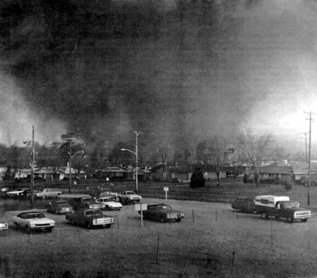
The 1974 Super Outbreak was the second-largest tornado outbreak on record for a single 24-hour period, just behind the 2011 Super Outbreak. It was also the most violent tornado outbreak ever recorded, with 30 F4/F5 tornadoes confirmed. From April 3–4, 1974, there were 148 tornadoes confirmed in 13 U.S. states and the Canadian province of Ontario. In the United States, tornadoes struck Illinois, Indiana, Michigan, Ohio, Kentucky, Tennessee, Alabama, Mississippi, Georgia, North Carolina, Virginia, West Virginia, and New York. The outbreak caused roughly $843 million USD in damage, with more than $600 million occurring in the United States. The outbreak extensively damaged approximately 900 sq mi (2,331 km2) along a total combined path length of 2,600 mi (4,184 km). At one point, as many as 15 separate tornadoes were occurring simultaneously.
The tornado near Depauw, Indiana.
The Xenia tornado tearing through the southeast Pinecrest Garden district.
A view of the destroyed Presbyterian Church in Monticello.
The tornado approaching the city of Madison.