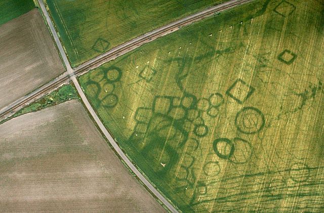
Cropmarks or crop marks are a means through which sub-surface archaeological, natural and recent features may be visible from the air or a vantage point on higher ground or a temporary platform. Such marks, along with parch marks, soil marks and frost marks, can reveal buried archaeological sites that are not visible from the ground.
Cropmarks at a protohistoric site at Grézac, France
Sketched diagram of a negative cropmark above a wall and a positive cropmark above a ditch
Crop marks in Gloucestershire. Cereal crop left, beans right. The relative intensity in the crops was reversed in the near infra-red.
Near infra-red kite aerial photo at Rufford Abbey, Nottinghamshire, UK
Aerial archaeology is the study of archaeological remains by examining them from a higher altitude. In present day, this is usually achieved by satellite images or through the use of drones.
Aerial archaeological photograph of the "Nazca monkey" in Peru
Aerial photograph of Barzan, showing the archaeological traces of a neolithic and later, the Gallo-Roman city of Novioregum
Diagram showing shadows and highlights from the sun, as would be seen from above, falling on a mild bank and a steep bank. (Diagram prepared by author)
Cropmarks at a protohistoric site at Grézac, France


