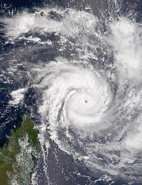
Very Intense Tropical Cyclone Hary was the strongest tropical cyclone in the 2001–02 South-West Indian Ocean cyclone season. Developing on March 5 from the monsoon trough, the storm initially moved generally to the west and gradually intensified. With favorable conditions, Hary quickly intensified on March 7, developing an eye and well-defined outflow. After reaching an initial peak, the cyclone briefly weakened due to an eyewall replacement cycle, by which time the storm turned southwestward toward Madagascar. Hary re-intensified and attained peak winds of 220 km/h (140 mph) on March 10 just offshore eastern Madagascar, which made it the first very intense tropical cyclone since 2000.
Cyclone Hary on March 8
2001–02 South-West Indian Ocean cyclone season
The 2001–02 South-West Indian Ocean cyclone season had the earliest named storm since 1992. Many storms formed in the north-east portion of the basin, and several more originated around Australia. The basin is defined as the waters of the Indian Ocean west of longitude 90°E to the coast of Africa and south of the equator. Eleven tropical storms formed, compared to an average of nine. Tropical systems were present during 73 days, which was significantly higher than the average of 58 for this basin.
2001–02 South-West Indian Ocean cyclone season
2001–02 South-West Indian Ocean cyclone season
2001–02 South-West Indian Ocean cyclone season
2001–02 South-West Indian Ocean cyclone season


