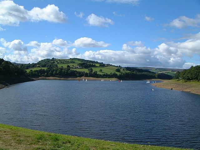
Damflask Reservoir is situated at grid reference SK277907 five miles west of the centre of Sheffield in the Loxley valley close to the village of Low Bradfield and within the city's boundaries. The hamlet of Stacey Bank is located to the east. The reservoir has a capacity of 4,250.9 million litres and has a surface area of 47 hectares with a maximum depth of 27 metres. The dam wall is approximately 400 metres wide with a height of 28 metres.
Damflask Reservoir from Ughill Heights
Damflask Reservoir seen from the dam wall with the hill of Ughill Heights in the background.
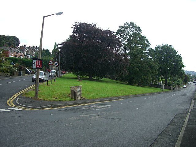
Loxley is a village and a suburb of the city of Sheffield, England. It is a long linear community which stretches by the side of the River Loxley and along the B6077 for almost 2.5 miles (4 km). Loxley extends from its borders with the suburbs of Malin Bridge and Wisewood westward to the hamlet of Stacey Bank near Damflask Reservoir. The centre of the suburb is situated at the junction of Rodney Hill and Loxley Road where the old village green stands and this is located 3 miles (5 km) north west of Sheffield city centre. The suburb falls within the Stannington ward of the City of Sheffield.
The centre of Loxley seen from Stannington village, 1.25 miles (2.01 km) to the south-west across the Loxley Valley.
The village green stands at the junction of Loxley Road and Rodney Hill. The copper beech tree was planted in 1935 to mark the Silver Jubilee of King George V.
Loxley Chase on the northern side of the Loxley Valley was formerly moorland that was converted to pasture land and enclosed by straight dry stone walls.
Old Wheel Dam created to drive the Old Wheel forge on the River Loxley near Rowell Bridge.