Dar es Salaam Region is one of Tanzania's 31 administrative regions and is located in the east coast of the country. The region covers an area of 1,393 km2 (538 sq mi). The region is comparable in size to the combined land and water areas of the nation state of Mauritius Dar es Salaam Region is bordered to the east by Indian Ocean and it is entirely surrounded by Pwani Region. The Pwani districts that border Dar es Salaam region are Bagamoyo District to the north, Kibaha Urban District to the west, Kisarawe District to the south west and Mkuranga District to the south of the region.
The region's seat (capital) is located inside the ward of Ilala. The region is named after the city of Dar es Salaam itself. The region is home to Tanzania's major finance, administration and industries, thus the making it the country's richest region. The region also has the second highest Human Development Index in the country after Mjini Magharibi. According to the 2022 census, the region has a total population of 5,383,728 and national census of 2012 had 4,364,541. The region has the highest population in Tanzania followed by Mwanza Region.

Image: Bus rapid transit in Dar es Salaam, Tanzania
Image: National Museum, Kivukoni Ward, Ilala
Image: Dar es Salaam at a bird's view
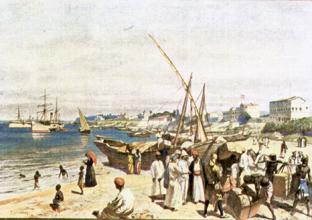
Image of the port of Dar es Salaam from the book Von Unseren Kolonien by Ottomar Beta in the year 1908
Pwani Region is one of Tanzania's 31 administrative regions. The word "Pwani" in Swahili means the "coast". The regional capital is the town of Kibaha. The Region borders the Tanga Region to the north, Morogoro Region to the west, Lindi Region to the south, and surrounds Dar es Salaam Region to the east. The Indian Ocean also borders the region to its northeast and southeast. The region is home to Mafia Island, the Rufiji delta and Saadani National Park. The region is home to Bagamoyo town, a historical Swahili settlement, and the first colonial capital of German East Africa. According to the 2012 national census, the region had a population of 1,098,668, which was slightly lower than the pre-census projection of 1,110,917. From 2002 to 2012, the region's 2.2 percent average annual population growth rate was the seventeenth-highest in the country. It was also the 21st most densely populated region with 34 people per square kilometre., According to the 2022 census the population had nearly doubled to 2,024,947. the region is slightly larger than Belgium.

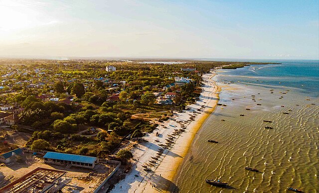
Image: Overhead view of the coastal area of Bagamoyo
Image: Vikindu Coconuts
Image: Architectural Detail Bagamoyo Tanzania 01
Zaramo Dance 1960s


