Des Voeux Road Central and Des Voeux Road West are two roads on the north shore of Hong Kong Island, Hong Kong. They were named after the 10th Governor of Hong Kong, Sir William Des Vœux. The name was sometimes spelt with the ligature œ in pre-war documents but is nowadays spelt officially as Des Voeux Road.
Des Voeux Road Central in Central in March 2015
Section of Des Voeux Road Central in May 2006, between the HSBC Main Building and Statue Square, looking toward Prince's Building.
Very DVRC campaign on 25 September 2016, a temporary street closure held to raise public awareness of walkability and open space issues
Hong Kong Island is an island in the southern part of Hong Kong. The island, known originally and on road signs simply as "Hong Kong", had a population of 1,289,500 and a population density of 16,390 per square kilometre (42,400/sq mi), as of 2008. The island had a population of about 3,000 inhabitants scattered in a dozen fishing villages when it was occupied by the United Kingdom in the First Opium War (1839–1842). In 1842, the island was formally ceded in perpetuity to the UK under the Treaty of Nanking and the City of Victoria was then established on the island by the British Force in honour of Queen Victoria.
The Central area on the island is the historical, political and economic centre of Hong Kong. The northern coast of the island forms the southern shore of the Victoria Harbour, which is largely responsible for the development of Hong Kong due to its deep waters favoured by large trade ships.
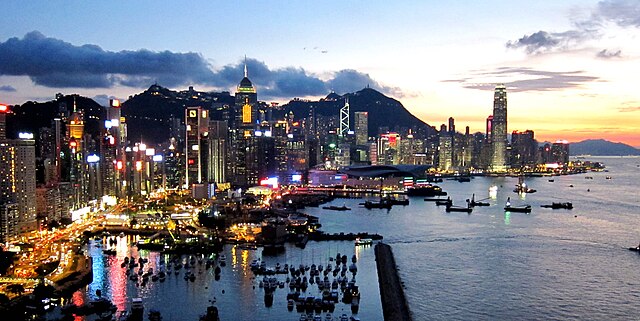
Dusk view of Hong Kong Island as viewed from North Point, August 2011
A view of Middle Island in the foreground and Repulse Bay in the background from the Ocean Park cable car ride (in the Southern District)
Kornhill and Shau Kei Wan, located in the northern part of Eastern District
Admiralty MTR station, the interchange station between the Tsuen Wan line, Island line, East Rail line, and South Island line