Deserts of Australia
Videos
The deserts of Australia or the Australian deserts cover about 2,700,000 km2 (1,000,000 sq mi), or 18% of the Australian mainland, but about 35% of the Australian continent receives so little rain, it is practically desert. Collectively known as the Great Australian desert, they are primarily distributed throughout the Western Plateau and interior lowlands of the country, covering areas from South West Queensland, Far West region of New South Wales, Sunraysia in Victoria and Spencer Gulf in South Australia to the Barkly Tableland in Northern Territory and the Kimberley region in Western Australia.

Typical landscape (Simpson Desert)

Wolfe Creek Crater in Western Australia

Pictographs known as Wandjina in the Wunnumurra Gorge, Barnett River, Kimberley, Western Australia

Strzelecki Desert in South Australia
Simpson Desert
Videos
The Simpson Desert is a large area of dry, red sandy plain and dunes in the Northern Territory, South Australia and Queensland in central Australia. It is the fourth-largest Australian desert, with an area of 176,500 km2 (68,100 sq mi).

Dunes at the edge of the Simpson Desert
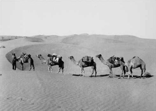
Ted Colson's expedition across the Simpson Desert in 1936

Big Red, Simpson Desert, 2007

Track through the Simpson Desert