Drakes Bay is a 4 mi (6 km) wide bay named so by U.S. surveyor George Davidson in 1875 along the Point Reyes National Seashore on the coast of northern California in the United States, approximately 30 mi (50 km) northwest of San Francisco at approximately 38 degrees north latitude. The bay is approximately 8 mi (13 km) wide. It is formed on the lee side of the coastal current by Point Reyes. The bay is named after Sir Francis Drake and has long been considered Drake's most likely landing spot on the west coast of North America during his circumnavigation of the world by sea in 1579. An alternative name for this bay is Puerto De Los Reyes.
2013 view
Drakes Bay
View of Drakes Bay from Drake's beach
View of Drakes Bay from Elephant Seal Overlook trail
Point Reyes National Seashore
Point Reyes National Seashore is a 71,028-acre (287.44 km2) park preserve located on the Point Reyes Peninsula in Marin County, California. As a national seashore, it is maintained by the US National Park Service as an important nature preserve. Some existing agricultural uses are allowed to continue within the park. Clem Miller, a US Congressman from Marin County, wrote and introduced the bill for the establishment of Point Reyes National Seashore in 1962 to protect the peninsula from development which was proposed at the time for the slopes above Drake's Bay.
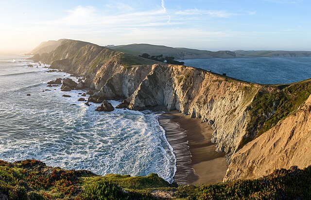
Headlands of the Point Reyes Peninsula from Chimney Rock, looking north
Point Reyes National Seashore
Tule Elk at Tomales Point
Elephant seal at Drakes Bay