Duarte is a city in Los Angeles County, California, United States. As of the 2020 census, the city population was 21,727. It is bounded to the north by the San Gabriel Mountains, to the north and west by the cities of Bradbury and Monrovia, to the south by the city of Irwindale, and to the east by the cities of Irwindale and Azusa. Duarte is located on historic U.S. Route 66 which today follows Huntington Drive through the middle of the city. The town is named after Andrés Avelino Duarte, a California ranchero who founded the community.
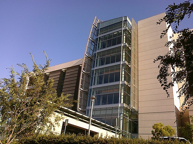
Helford Clinical Research Hospital at the City of Hope National Medical Center
Andrés Avelino Duarte statue, honoring the Californio ranchero and namesake of the city.
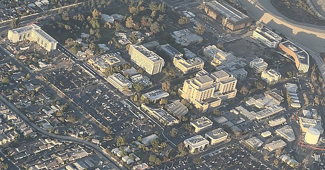
Aerial view of City of Hope campus (2021)
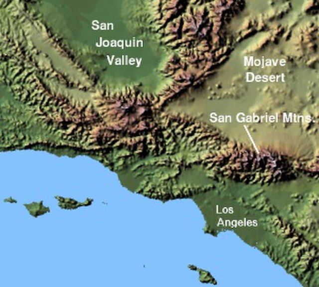
The San Gabriel Mountains comprise a mountain range located in northern Los Angeles County and western San Bernardino County, California, United States. The mountain range is part of the Transverse Ranges and lies between the Los Angeles Basin and the Mojave Desert, with Interstate 5 to the west and Interstate 15 to the east. The range lies in, and is surrounded by, the Angeles and San Bernardino National Forests, with the San Andreas Fault as its northern border.
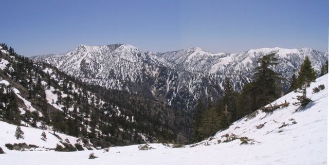
Summits in the eastern San Gabriel Mountains, Angeles National Forest, San Bernardino County, California. The main peaks are: Telegraph Peak 8,985 feet (2,739 m) (left), Cucamonga Peak, 8,859 feet (2,700 m) (center), and Ontario Peak 8,693 feet (2,650 m) (center right), as seen from Baldy Bowl on Mount Baldy.
Image: Wpdms shdrlfi 020l san gabriel mountains
East Fork San Gabriel River canyon, looking west.
Mount Harwood, from Devils Backbone