Dumyat or Dunmyat is a hill at the western extremity of the Ochil Hills in central Scotland. The name is thought to originate from Dun of the Maeatae.
view of the south elevation of the Dumyat.
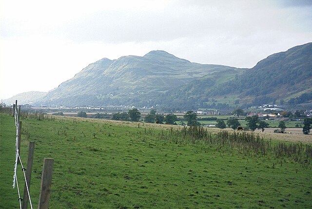
A view of Dumyat from the site of the old Devon Colliery. Menstrie is visible at the base of the hill, with Menstrie Glen to the right.
This photo shows the memorial to the regiment of Argyll and Sutherland Highlanders and also the beacon brazier now filled with stones
View from Dumyat looking south-east towards Grangemouth Refinery's cooling towers and the River Forth, December 2013
The Ochil Hills is a range of hills in Scotland north of the Forth valley bordered by the cities of Stirling, Perth and the towns of Alloa, Kinross, and Auchterarder. The only major roads crossing the hills pass through Glen Devon/Glen Eagles and Glenfarg, the latter now largely replaced except for local traffic by the M90 Edinburgh-Perth motorway cutting through the eastern foothills. The hills are part of a Devonian lava extrusion whose appearance today is largely due to the Ochil Fault which results in the southern face of the hills forming an escarpment. The plateau is undulating with no prominent peak, the highest point being Ben Cleuch at 721 m (2,365 ft). The south-flowing burns have cut deep ravines including Dollar Glen, Silver Glen and Alva Glen, often only passable with the aid of wooden walkways.
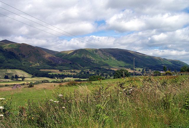
Ochil Hills (Wood Hill and Elistoun Hill) viewed from south-west of Tillicoultry
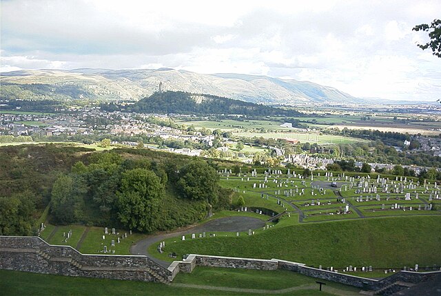
Ochil Hills viewed from Stirling Castle. The scarp face formed by the line of the Ochil Fault can be seen clearly. The Abbey Craig is in the middle distance.
A downed Cessna 152, lying between Andrew Gannel Hill and The Law, in 2006. The pilot was not injured in the crash
Ochil Hills and statue of Robert the Bruce as seen from Stirling Castle