Dupont Circle is a historic roundabout park and neighborhood of Washington, D.C., located in Northwest D.C. The Dupont Circle neighborhood is bounded approximately by 16th Street NW to the east, 22nd Street NW to the west, M Street NW to the south, and Florida Avenue NW to the north. Much of the neighborhood is listed on the National Register of Historic Places. However, the local government Advisory Neighborhood Commission and the Dupont Circle Historic District have slightly different boundaries.
Image: Dupont Circle fountain facing southwest
Image: Patterson House (cropped)
Image: 1609 and 1611 Connecticut Avenue NW
Image: Cathedral of St. Matthew the Apostle (Washington, D.C.)
Northwest (Washington, D.C.)
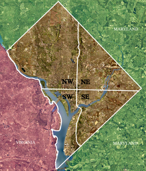
Northwest is the northwestern quadrant of Washington, D.C., the capital of the United States, and is located north of the National Mall and west of North Capitol Street. It is the largest of the four quadrants of the city, and it includes the central business district, the Federal Triangle, and the museums along the northern side of the National Mall, as well as many of the District's historic neighborhoods.
Color-enhanced USGS satellite image of Washington, D.C. with the crosshairs marking the quadrant divisions of Washington, D.C., with the U.S. Capitol at the center of the dividing lines. To the west of the Capitol extends the National Mall, visible as a slight green band in the image. The Northwest quadrant is the largest, located north of the Mall and west of North Capitol Street.
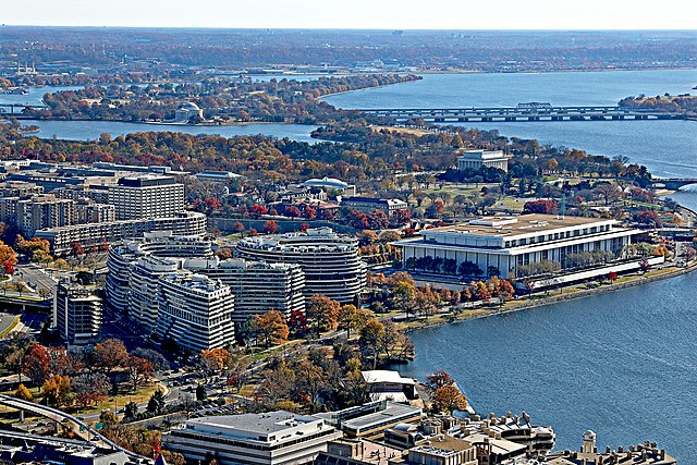
The Watergate complex (left) and the Kennedy Center (right) in the Foggy Bottom neighborhood
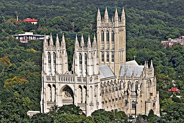
Washington National Cathedral
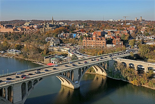
Francis Scott Key Bridge