Eastern Ontario
Videos
Photos
Eastern Ontario is a secondary region of Southern Ontario in the Canadian province of Ontario which lies in a wedge-shaped area between the Ottawa River and St. Lawrence River. It shares water boundaries with Quebec to the north and New York State to the east and south, as well as a small land boundary with the Vaudreuil-Soulanges region of Quebec to the east.

Downtown Ottawa

Thousand Islands

Queens Theological Hall
French language
Videos
Photos
French is a Romance language of the Indo-European family. It descended from the Vulgar Latin of the Roman Empire, as did all Romance languages. French evolved from Gallo-Romance, the Latin spoken in Gaul, and more specifically in Northern Gaul. Its closest relatives are the other langues d'oïl—languages historically spoken in northern France and in southern Belgium, which French (Francien) largely supplanted. French was also influenced by native Celtic languages of Northern Roman Gaul like Gallia Belgica and by the (Germanic) Frankish language of the post-Roman Frankish invaders. Today, owing to the French colonial empire, there are numerous French-based creole languages, most notably Haitian Creole. A French-speaking person or nation may be referred to as Francophone in both English and French.

Distribution of native French speakers in 6 countries in 2023
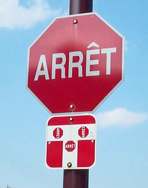
The "arrêt" signs (French for "stop") are used in the province of Québec, Canada while the English stop, which is also a valid French word, is used in France and other French-speaking countries and regions.

Town sign in Standard Arabic and French at the entrance of Rechmaya in Lebanon

A 500-CFP franc (€4.20; US$5.00) banknote, used in French Polynesia, New Caledonia and Wallis and Futuna