Eastfield, South Lanarkshire
Eastfield is a mainly residential district in South Lanarkshire, Scotland, located between the industrial towns of Rutherglen and Cambuslang in the south-east of the Greater Glasgow urban area. It is situated south of the River Clyde, adjoining the Stonelaw and Burnside neighbourhoods of Rutherglen, and Silverbank in Cambuslang.
Aerial photograph of the area from the South-west (2017)
Houses on Whinfield Avenue
modern flats on Dukes Road
Langfield Inn (public house, demolished 2006)
Rutherglen is a town in South Lanarkshire, Scotland, immediately south-east of the city of Glasgow, three miles from its centre and directly south of the River Clyde. Having previously existed as a separate Lanarkshire burgh, in 1975 Rutherglen lost its own local council and administratively became a component of the City of Glasgow District within the Strathclyde region. In 1996 the towns were reallocated to the South Lanarkshire council area.
Main Street, the main shopping area of Rutherglen
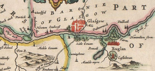
Rutherglen's prominence in late mediaeval Lanarkshire is shown in the Blaeu Atlas of Scotland (1654) - Castlemilk House (‘Casteltoun’), Shawfield and Farme Castle are also shown
Faces of double-sided seal as published in 1793
Seal as depicted in 1882


