Eighth Avenue (Manhattan)
Videos
Eighth Avenue is a major north–south avenue on the west side of Manhattan in New York City, carrying northbound traffic below 59th Street. It is one of the original avenues of the Commissioners' Plan of 1811 to run the length of Manhattan, though today the name changes twice: At 59th Street/Columbus Circle, it becomes Central Park West, where it forms the western boundary of Central Park, and north of 110th Street/Frederick Douglass Circle, it is known as Frederick Douglass Boulevard before merging onto Harlem River Drive north of 155th Street.

Facing north on Eighth Avenue from 32nd Street

Hearst Tower at West 57th Street and Eighth Avenue
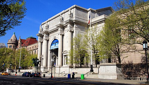
The American Museum of Natural History at 200 Central Park West

Housing cooperatives on Central Park West: The San Remo (far right), The Langham (center-right), The Dakota (center-left), and The Majestic (far left)
Central Park
Videos
Central Park is an urban park between the Upper West Side and Upper East Side neighborhoods of Manhattan in New York City that was the first landscaped park in the United States. It is the sixth-largest park in the city, containing 843 acres (341 ha), and the most visited urban park in the United States, with an estimated 42 million visitors annually as of 2016.

Aerial view of southern Central Park (September 2014)

Panoramic view of Central Park from Rockefeller Center

Central Park in 2004

Randel's surveying bolt