El Camino Real (California)
Videos
El Camino Real is a 600-mile commemorative route connecting the 21 Spanish missions in California from Mission San Diego de Alcalá in San Diego to Mission San Francisco Solano in Sonoma, along with a

East entrance of San Gabriel Mission with an El Camino Real bell

El Camino Real and Couts Path, drawn in 1850 by Cave J. Couts.

A historical marker situated along El Camino Real
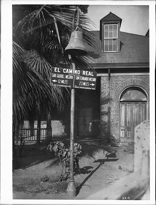
One of the commemorative bells, placed at El Pueblo de Los Ángeles Historical Monument with wayfinding markers to Mission San Fernando and Mission San Gabriel
The Spanish missions in California formed a series of 21 religious outposts or missions established between 1769 and 1833 in what is now the U.S. state of California. The missions were established by
El Camino Real (California)
…Spanish; literally The Royal Road, sometimes translated as The King's Highway) is a 600-mile (965-kilometer) commemorative route connecting the 21 Spanish missions in California (formerly the region Alta California in the Spanish Empire) from Mission San Diego de Alcalá in San Diego to Mission San Francisco Solano in Sonoma…

A view of Mission San Juan Capistrano. At left is the façade of the first adobe church with its added espadaña; behind the campanario, or "bell wall" is the "Sacred Garden". The Mission has earned a reputation as the "Loveliest of the Franciscan Ruins".

Mission San Luis Rey de Francia, circa 1910. This mission is architecturally distinctive because of the strong Moorish lines exhibited.

The Missionaries as They Came and Went. Franciscans of the California missions donned gray habits, in contrast to the brown that is typically worn today.

A drawing of Mission San Carlos Borromeo de Carmelo prepared by Captain George Vancouver depicts the grounds as they appeared in November 1792. From A Voyage of Discovery to the North Pacific Ocean and Round the World.