The Elysium quadrangle is one of a series of 30 quadrangle maps of Mars used by the United States Geological Survey (USGS) Astrogeology Research Program. The Elysium quadrangle is also referred to as MC-15.
Image of the Elysium Quadrangle (MC-15). The north includes relatively smooth lowland plains. Elysium Mons and Albor Tholus are in the northwest and Orcus Patera is in the east.
Lava flow in Elysium. There are many lava flows in Elysium. In this one, the lava flowed toward the upper right. Image taken by Mars Global Surveyor, under the MOC Public Targeting Program.
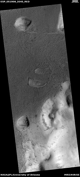
Lava flow, as seen by HiRISE under HiWish program. Dark slope streaks are also visible.
Close view of lava flow, as seen by HiRISE under HiWish program. Dark slope streaks are also visible.
Elysium Planitia, located in the Elysium and Aeolis quadrangles, is a broad plain that straddles the equator of Mars, centered at 3.0°N 154.7°E. It lies to the south of the volcanic province of Elysium, the second largest volcanic region on the planet, after Tharsis. Elysium contains the major volcanoes Elysium Mons, Albor Tholus and Hecates Tholus. Another more ancient shield volcano, Apollinaris Mons, is situated just to the south of eastern Elysium Planitia. Within the plains, Cerberus Fossae is the only Mars location with recent volcanic eruptions. Lava flows dated no older than 0.2 million years from the present have been found, and evidence has been found that volcanic activity may have occurred as recently as 53,000 years ago. Such activity could have provided the environment, in terms of energy and chemicals, needed to support life forms.
Elysium Planitia
Image footprints by HiRise on Mars Reconnaissance Orbiter for studying the planned Insight landing ellipse. From east to west the scale is about 160 km (100 mi).
InSight backshell with parachute, lander, heat shield (11 December 2018)
InSight backshell with parachute, lander, heat shield (26 November 2018)