Forth and Clyde Canal
Videos
The Forth and Clyde Canal is a canal opened in 1790, crossing central Scotland; it provided a route for the seagoing vessels of the day between the Firth of Forth and the Firth of Clyde at the narrowe

The Forth and Clyde Canal, near Bonnybridge and Larbert

Bar Hill and Twechar with Kilsyth and Croy in the background

The branch within Glasgow from Maryhill to Port Dundas, showing Ruchill Church.

The unique Drop Lock at Dalmuir takes boats below a fixed bridge.
Falkirk Wheel
Videos
The Falkirk Wheel is a rotating boat lift in Tamfourhill, Falkirk, in central Scotland, connecting the Forth and Clyde Canal with the Union Canal. It opened in 2002 as part of the Millennium Link proj
Forth and Clyde Canal
…in the 1930s. As part of the millennium celebrations in 2000, National Lottery funds were used to regenerate both canals. A boatlifting device, the Falkirk Wheel, was built to connect the two canals and once more allow boats to travel from the Clyde or Glasgow to Edinburgh, with a new canal connection to the…
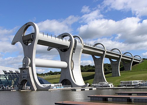
The Falkirk Wheel

View of the aqueduct and top of the wheel

The construction of the basin

Members of the Royal Family at the opening ceremony