Forth and Clyde Canal Pathway
The Forth and Clyde canal pathway runs between the Firth of Forth and the Firth of Clyde and is a 106-kilometre-long (66 mi) footpath and cycleway that runs across Scotland, between Bowling, west of Glasgow, and Lochrin Basin in Edinburgh. The path runs on the towpaths of the Forth & Clyde and Union Canals and is entirely off-road. The path is well maintained and its surface is generally good, although there are some stretches particularly between Falkirk and the outskirts of Edinburgh where wet weather leads to muddy conditions unsuitable for road intended bicycles. It is well used by walkers and cyclists, and designated as one of Scotland's Great Trails by NatureScot. It also forms part of the National Cycle Network, being designated as Route 754. Sustrans advises that the path is best followed from the Clyde to the Forth because the prevailing wind is from the south west. Much of the path is also suitable for experienced horseriders, although in some places low bridges, narrow aqueducts and gates may restrict access for horses.

Along the canal pathway
View of Edinburgh Quay. A school party can be seen using the towpath on the left.
The canal, seen beyond the M8 motorway, deviates northwards just south of Broxburn, West Lothian.
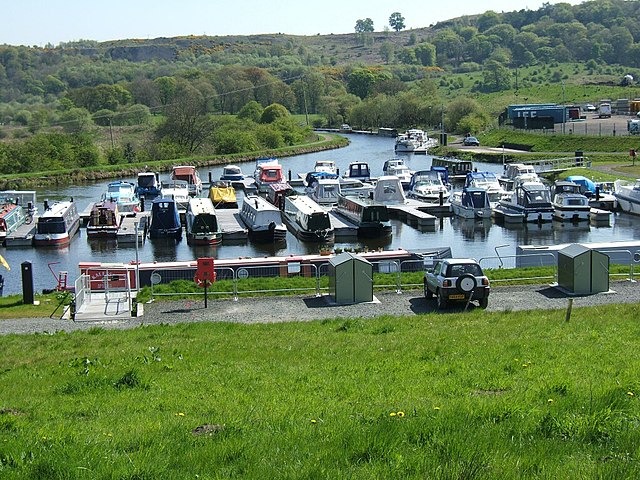
Auchinstarry Basin
A towpath is a road or trail on the bank of a river, canal, or other inland waterway. The purpose of a towpath is to allow a land vehicle, beasts of burden, or a team of human pullers to tow a boat, often a barge. This mode of transport was common where sailing was impractical due to tunnels and bridges, unfavourable winds, or the narrowness of the channel.
A towpath in use on the Finow Canal in Germany
People towing a vessel in the Netherlands in 1931
Mules pulling a boat on the Chesapeake and Ohio Canal
A roving bridge on the English Staffordshire and Worcestershire Canal. The towpath changes to the other side of the canal but the horse does not have to be unhitched.


