Pauri
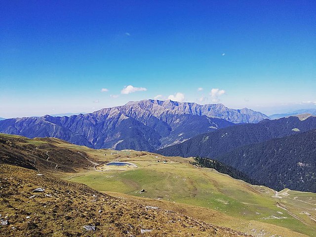
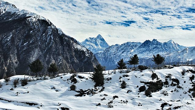
Pauri is a town and a municipal board in Pauri Garhwal district in the Indian state of Uttarakhand. Pauri is the seat of the Divisional Commissioner of the Garhwal Division. Beautiful valleys, azure sky, deep gorges makes Pauri a well suited summer destination. Pauri is located at 30.15°N 78.78°E / 30.15. It is located 1,814 metres above sea level. Pauri provides a panoramic view of the snow-covered Himalayan peaks of Nanda Devi and Trisul, Gangotri Group, Thalaiya-Sagar, Bandar Poonch, Kedarnath, Kharcha Kund, Chaukhamba, Haathi Parvat, etc; the errand across Kandoliya-Tekka stretch along evergreen deodar trees is worth walking. The town is visited by tourists and students from across the world; the place is paradise for paragliding enthusiasts and nature lovers. The region has a sub-temperate to temperate climate; the climate of Pauri is cold in winters and the region experiences low to moderate snowfall in the months of January or February. The climate is soothing in summer when flowers bloom in the nearby forests and tourists flock to town.
In rainy season the climate is cool and lush greenery covers the town. According to the Census India 2011 the Pauri Nagar Palika Parishad has population of 25,440 of which 13,090 are males while 12,350 are females. Population of Children with age of 0-6 is 2766, 10.87% of total population of Pauri. In Pauri Nagar Palika Parishad, Female Sex Ratio is of 943 against state average of 963. Moreover, Child Sex Ratio in Pauri is around 877 compared to Uttarakhand state average of 890. Literacy rate of Pauri city is 92.18% higher than state average of 78.82%. In Pauri, Male literacy is around 95.74% while female literacy rate is 88.44%. Pauri Nagar Palika Parishad has total administration over 6,127 houses to which it supplies basic amenities like water and sewerage; as of 2001 India census, Pauri had a population of 24,742. Males constitute 53% of the population and females 47%. In Pauri, 12% of the population is under 6 years of age; the language most used in Pauri Garhwal is Garhwali. This is one of the most premier institutions of the town providing English medium education up to 12th class under CBSE board.
Located amidst the beautiful deodar and Oak trees makes it a perfect place for educating the young minds. It is being run from a temporary campus in Kandoliya but a permanent building is all set in Siroli village, 8km from the town. Govind Ballabh Pant Engineering College is an autonomous State Government Higher Technical Institution, it was created in 1989 to honour the great Indian Govind Ballabh Pant. The institute is located in serenity and purity of the Garhwal Himalayas, at a height of 1800m above Sea Level and overlooks the Great Himalayan Range on its East flank; the college offers courses like Bachelor of Technology, Master of Technology and Master of Computer Applications. The college offers Mechanical Engineering, Electronics & Communication Engineering, Electrical Engineering, Computer Science & Engineering, Civil Engineering, Production Engineering and Biotechnology. Dr. B. G. R Campus, referred to as the Pauri campus of Hemwati Nandan Bahuguna Garhwal University is a full-fledged educational campus established in 1971.
Pauri College is one of the three campuses of Hemwati Nandan Bahuguna Garhwal University, located in Srinagar, Garhwal. The campus offers arts and law courses at graduation, post graduation and research fellowships levels. Located amidst the thick forest cover, the college offers a perfect educational environment to its students. St. Thomas School is a premier educational institution in the town, established in 1973; the school comes under the Bijnor Diocese, headed by Rev. John Vadakle, it offers education in Science up to class 12th. It is an English medium school affiliated with ICSE board; this co-educational school has the record of offering 100% pass result in its last 40 years history. Established in the British era, Messmore Inter College or MIC is one of the oldest schools in the Garhwal region; the school offers education in science and arts up to class 12th. This is government aided school; the school is co-educational. This college belongs to the association of Methodist churches in India.
This is government aided school. The school offers co-education. Sri Guru Ram Rai Public School was established by SGRR education mission in the heart of the city with easy accessibility from different corner of the city. School has a magnificent school building equipped with modern aminities, it has a team of qualified and hardworking teachers. The school is running classes from I to XII and is offering streams science and humanities for classes XI and XII, it is to proclaim that the school is the only school in the town to offer new subject Biotechnology as an elective subject for classes XI and XII. Shri Guru Ram Rai Public School Pauri Garhwal has achieved high water mark by distinguished performance of the students in the field of academics, extra curricular activities, finearts and in many other inter school competitions; this is government aided school. The school is affiliated with Uttarakhand Board; this is government aided school. The school is affiliated with Uttarakhand Board. Kandoliya Mandir- Kandoliya devta is the local deity, referred in the local language as the bhumi devta.
The temple has been in the area for amidst thick pine forest. In the region, it is a custom to begin every auspicious work with the blessings of Kandoliya th
Order of the Star of India
The Most Exalted Order of the Star of India is an order of chivalry founded by Queen Victoria in 1861. The Order includes members of three classes: Knight Grand Commander Knight Commander Companion No appointments have been made since the 1948 New Year Honours, shortly after the Partition of India in 1947. With the death in 2009 of the last surviving knight, the Maharaja of Alwar, the order became dormant; the motto of the order was Heaven's light our guide. The "Star of India", the emblem of the order appeared on the flag of the Viceroy of India and other flags used to represent British India; the order is the fifth most senior British order of chivalry, following the Order of the Garter, Order of the Thistle, Order of St Patrick and Order of the Bath. It is the senior order of chivalry associated with the British Raj. Several years after the Indian Mutiny and the consolidation of Great Britain's power as the governing authority in India, it was decided by the British Crown to create a new order of knighthood to honour Indian Princes and Chiefs, as well as British officers and administrators who served in India.
On 25 June 1861, the following proclamation was issued by the Queen: The Queen, being desirous of affording to the Princes and People of the Indian Empire, a public and signal testimony of Her regard, by the Institution of an Order of knighthood, whereby Her resolution to take upon Herself the Government of the Territories in India may be commemorated, by which Her Majesty may be enabled to reward conspicuous merit and loyalty, has been graciously pleased, by Letters Patent under the Great Seal of the United Kingdom of Great Britain and Ireland, to institute, erect and create, an Order of Knighthood, to be known by, have for hereafter, the name and designation, of "The Most Exalted Order of the Star of India" The first appointees were: HRH The Prince Consort HRH The Prince of Wales The Rt Hon Earl Canning, GCB, Governor-General of India and Grand Master of the Most Exalted Order of the Star of India HH Maharaja Shri Sir Vaghji Thakor Morvi State for representing Kathiyawar on the day of Victoria's Jubilee Ceremony given by Queen Victoria for this honor HH Sir Vaghaji Thakor make them Sister.
HH Nawab Mir Tahniat Ali Khan Bahadur, Afzal ad-Dawlah, Asaf Jah V, the Nizam of Hyderabad HH Jayajirao Scindia, Maharaja of Gwalior HH Raja Bahadur Bindeshwari Prasad Singh Deo, Raja of Udaipur state in Chota Nagpur States. HH Maharaja Duleep Singh, former Maharaja of the Sikh Empire HH Ranbir Singh, Maharaja of Jammu and Kashmir HH Tukojirao Holkar, Maharaja of Indore HH Narendra Singh, Maharaja of Patiala HH Khanderrao Gaekwad, Maharaja of Baroda HRH Maharaja Bir Shamsher Jang Bahadur Rana of Nepal HH Nawab Sikander Begum, Nawab Begum of Bhopal HH Yusef Ali Khan Bahadur, Nawab of Rampur The Rt Hon Viscount Gough, Commander-in-Chief of the Indian Army The Rt Hon Lord Harris, Governor of Madras The Rt Hon Lord Clyde, Commander-in-Chief of the Indian Army Sir George Russell Clerk, Governor of Bombay Sir John Laird Mair Lawrence, Bt, GCB, Lieutenant-Governor of the Punjab Sir James Outram, Bt, GCB, Member of the Viceroy's Council Sir Hugh Henry Rose, GCB, Commander-in-Chief of the Indian Army HEH Nizam Sir Mir Osman Ali Khan Siddiqi Bayafandi Asaf Jah VII, 7th Nizam of HyderabadThe Order of the Indian Empire, founded in 1877, was intended to be a less exclusive version of the Order of the Star of India.
The last appointments to the orders relating to the British Empire in India were made in the 1948 New Year Honours, some months after the Partition of India in August 1947. The orders have never been formally abolished, Elizabeth II succeeded her father George VI as Sovereign of the Orders when she ascended the throne in 1952, she remains Sovereign of the Order to this day. However, there are no living members of the order. There were only three female members of the Order: Sultan Shah Jahan, Begum of Bhopal and her daughter, Hajjah Nawab Begum Dame Sultan Jahan, Mary of Teck; the last Grand Master of the Order, Admiral of the Fleet The Earl Mountbatten of Burma, was assassinated by the Provisional IRA on 27 August 1979. The last surviving Knight Grand Commander, HH Maharaja Sree Padmanabhadasa Sir Chithira Thirunal Balarama Varma GCSI, GCIE, Maharajah of Travancore; the last surviving Knight Commander, HH Maharaja Sir Tej Singh Prabhakar Bahadur KCSI, Maharaja of Alwar, died on 15 February 2009 in New Delhi.
The last surviving Companion of the Order, Vice-Admiral Sir Ronald Brockman CSI, died on 3 September 1999 in London. The British Sovereign was, still is, Sovereign of the Order; the next most senior member was the Grand Master, a position held ex officio by the Viceroy of India. When the order was established in 1861, there was only one class of Knights Companion, who bore the postnominals KSI. In 1866, however, it was expanded to three classes. Members of the first class were known as "Knights Grand Commander" so as not to offend the non-Christian Indians appointed to the Order. All those surviving members, made Knights Companion of the Order were retroactively known as Knights Grand Commander. Former viceroys and other high officials, as well as those who served in the Department of the Secretary of State for India for at least thirty years were eligible for appointment. Rulers of Indian Princely States were eligible for appointment; some states were of such importance that their rulers were always appointed
Uttarakhand
Uttarakhand known as Uttaranchal, is a state in the northern part of India. It is referred to as the Devabhumi due to a large number of Hindu temples and pilgrimage centres found throughout the state. Uttarakhand is known for the natural environment of the Bhabhar and the Terai. On 9 November 2000, Uttarakhand became the 27th state of the Republic of India, being created from the Himalayan districts of Uttar Pradesh, it borders Tibet Autonomous Region of China to the north. The state is divided into two divisions and Kumaon, with a total of 13 districts; the interim capital of Uttarakhand is Dehradun, the largest city of the state, a railhead. The High Court of the state is located in Nainital. Archaeological evidence supports the existence of humans in the region since prehistoric times; the region formed a part of the Uttara Kuru Kingdom during the Vedic age of Ancient India. Among the first major dynasties of Kumaon were the Kunindas in the 2nd century BCE who practised an early form of Shaivism.
Ashokan edicts at Kalsi show the early presence of Buddhism in this region. During the medieval period, the region was consolidated under the Kumaon Kingdom and Garhwal Kingdom. In 1816, most of modern Uttarakhand was ceded to the British as part of the Treaty of Sugauli. Although the erstwhile hill kingdoms of Garhwal and Kumaon were traditional rivals, the proximity of different neighboring ethnic groups and the inseparable and complementary nature of their geography, culture and traditions created strong bonds between the two regions which further strengthened during the Uttarakhand movement for statehood in the 1990s; the natives of the state are called Uttarakhandi, or more either Garhwali or Kumaoni by their region of origin. According to the 2011 Census of India, Uttarakhand has a population of 10,086,292, making it the 20th most populous state in India. Uttarakhand's name is derived from the Sanskrit words uttara meaning'north', khaṇḍa meaning'land', altogether meaning'Northern Land'.
The name finds mention in early Hindu scriptures as the combined region of "Kedarkhand" and "Manaskhand". Uttarakhand was the ancient Puranic term for the central stretch of the Indian Himalayas. However, the region was given the name Uttaranchal by the Bharatiya Janata Party led central government and Uttar Pradesh state government when they started a new round of state reorganisation in 1998. Chosen for its less separatist connotations, the name change generated enormous controversy among many activists for a separate state who saw it as a political act; the name Uttarakhand remained popular in the region while Uttaranchal was promulgated through official usage. In August 2006, Union Cabinet of India assented to the demands of the Uttaranchal Legislative Assembly and leading members of the Uttarakhand statehood movement to rename Uttaranchal state as Uttarakhand. Legislation to that effect was passed by the Uttaranchal Legislative Assembly in October 2006, the Union Cabinet brought in the bill in the winter session of Parliament.
The bill was passed by Parliament and signed into law by President A. P. J. Abdul Kalam in December 2006, since January 1, 2007 the state has been known as Uttarakhand. Ancient rock paintings, rock shelters, paleolithic stone tools, megaliths provide evidence that the mountains of the region have been inhabited since prehistoric times. There are archaeological remains which show the existence of early Vedic practices in the area; the Pauravas, Mauryans, Kunindas, Gurjara-Pratihara, Raikas, Karkotas, Parmars or Panwars, the British have ruled Uttarakhand in turns. It is believed. Among the first major dynasties of Garhwal and Kumaon were the Kunindas in the 2nd century BCE who practised an early form of Shaivism and traded salt with Western Tibet, it is evident from the Ashokan edict at Kalsi in Western Garhwal that Buddhism made inroads in this region. Folk shamanic practices deviating from Hindu orthodoxy persisted here; however and Kumaon were restored to nominal Hindu rule due to the travels of Shankaracharya and the arrival of migrants from the plains.
Between the 4th and 14th centuries, the Katyuri dynasty dominated lands of varying extent from the Katyur valley in Kumaon. The significant temples at Jageshwar are believed to have been built by the Katyuris and remodelled by the Chands. Other peoples of the Tibeto-Burman group known as Kirata are thought to have settled in the northern highlands as well as in pockets throughout the region, are believed to be ancestors of the modern day Bhotiya, Raji and Tharu people. By the medieval period, the region was consolidated under the Garhwal Kingdom in the west and the Kumaon Kingdom in the east. During this period and new forms of painting developed. Modern-day Garhwal was unified under the rule of Parmars who, along with many Brahmins and Rajputs arrived from the plains. In 1791, the expanding Gorkha Empire of Nepal overran the seat of the Kumaon Kingdom, it was annexed to Kingdom of Nepal by Amar Singh Thapa. In 1803, the Garhwal Kingdom fell to the Gurkhas. After the Anglo-Nepalese War, this region was ceded to the British as part of the Treaty of Sugauli.
The Garhwal Kingdom was re-established from a smaller region in Tehri. Af
Borax
Borax known as sodium borate, sodium tetraborate, or disodium tetraborate, is an important boron compound, a mineral, a salt of boric acid. Powdered borax is white, consisting of soft colorless crystals that dissolve in water. A number of related minerals or chemical compounds that differ in their crystal water content are referred to as borax, but the word is used to refer to the octahydrate. Commercially sold borax is dehydrated. Borax is a component of many detergents and enamel glazes, it is used to make buffer solutions in biochemistry, as a fire retardant, as an anti-fungal compound, in the manufacture of fiberglass, as a flux in metallurgy, neutron-capture shields for radioactive sources, a texturing agent in cooking, as a precursor for other boron compounds, along with its inverse, boric acid, is useful as an insecticide. In artisanal gold mining, borax is sometimes used as part of a process meant to eliminate the need for toxic mercury in the gold extraction process, although it cannot directly replace mercury.
Borax was used by gold miners in parts of the Philippines in the 1900s. Borax was first discovered in dry lake beds in Tibet and was imported via the Silk Road to the Arabian Peninsula in the 8th century AD. Borax first came into common use in the late 19th century when Francis Marion Smith's Pacific Coast Borax Company began to market and popularize a large variety of applications under the 20 Mule Team Borax trademark, named for the method by which borax was hauled out of the California and Nevada deserts; the term borax is used for a number of related minerals or chemical compounds that differ in their crystal water content: anhydrous sodium tetraborate, Na2B4O7 sodium tetraborate pentahydrate, Na2B4O7·5H2O sodium tetraborate decahydrate, Na2B4O7·10H2O or equivalently the octahydrate, Na2B4O54·8H2OFrom the chemical perspective, borax contains the 2− ion. In this structure, there are two four-coordinate boron centers and two three-coordinate boron centers. Borax is easily converted to boric acid and other borates, which have many applications.
Its reaction with hydrochloric acid to form boric acid is: Na2B4O7·10H2O + 2 HCl → 4 B3 + 2 NaCl + 5 H2OThe "decahydrate" is sufficiently stable to find use as a primary standard for acid base titrimetry. When borax is added to a flame, it produces a yellow green color. Borax is not used for this purpose in fireworks due to the overwhelming yellow color of sodium. Boric acid is used to color methanol flames a transparent green. Borax is soluble in ethylene glycol, moderately soluble in diethylene glycol and methanol soluble in acetone, it is poorly soluble in cold water, but its solubility increases with temperature. The English word borax is Latinized: the Middle English form was boras, from Old French boras, bourras; that may have been from medieval Latin baurach, borax, along with Spanish borrax and Italian borrace, in the 9th century. Another name for borax is tincal, from Sanskrit; the word tincal "tinkle", or tincar "tinker", refers to crude borax, before it is purified, as mined from lake deposits in Tibet and other parts of Asia.
The word was adopted in the 17th century from Malay tingkal and from Urdu/Persian/Arabic تنکار tinkār/tankār. These all appear to be related to the Sanskrit टांकण ṭānkaṇa. Borax occurs in evaporite deposits produced by the repeated evaporation of seasonal lakes; the most commercially important deposits are found in: Turkey. Borax has been found at many other locations in the Southwestern United States, the Atacama desert in Chile, newly discovered deposits in Bolivia, in Tibet and Romania. Borax can be produced synthetically from other boron compounds. Occurring borax is refined by a process of recrystallization. Borax is used in various household laundry and cleaning products, including the "20 Mule Team Borax" laundry booster, "Boraxo" powdered hand soap, some tooth bleaching formulas. Borate ions are used in biochemical and chemical laboratories to make buffers, e.g. for polyacrylamide gel electrophoresis of DNA and RNA, such as TBE buffer or the newer SB buffer or BBS buffer in coating procedures.
Borate buffers are used as preferential equilibration solution in dimethyl pimelimidate based crosslinking reactions. Borax as a source of borate has been used to take advantage of the co-complexing ability of borate with other agents in water to form complex ions with various substances. Borate and a suitable polymer bed are used to chromatograph non-glycosylated hemoglobin differentially from glycosylated hemoglobin, an indicator of long term hyperglycemia in diabetes mellitus. Borax alone does not have a high affinity for the hardness cations, although it has been used for water-softening, its chemical equation for water-softening is given below: Ca2+ + Na2B4O7 → CaB4O7 ↓ + 2 Na+ Mg2+ + Na2B4O7 → MgB4O7 ↓ + 2 Na+ The sodium ions introduced do not make water ‘hard’. This method is suitable for removing both permanent types of hardness. A mixture of borax and ammonium chloride is used as a flux when welding steel, it lowers the melting point of the unwanted iron oxide. Borax is used mixed with water as a flux when soldering jewelry metals such as gold or silver, where it allows the molten solder to wet the metal and flow evenly int
Anglo-Nepalese War
The Anglo-Nepalese War known as the Gurkha War, was fought between the Kingdom of Gorkha and the East India Company as a result of border disputes and ambitious expansionism of both the belligerent parties. The war ended with the signing of the Treaty of Sugauli in 1816, which ceded some Nepalese controlled territory to the British; the Shah era of Nepal began with the Gorkha king Prithvi Narayan Shah invading Kathmandu valley, which consisted of the capital of the Malla confederacy. Until that time only the Kathmandu valley was referred to as Nepal; the confederacy requested help from the East India Company and an ill-equipped and ill-prepared expedition numbering 2,500 was led by Captain Kinlock in 1767. The expedition was a disaster; this ineffectual British force provided the Gorkhali with few firearms to arms themselves and make effective use of it. Victory and occupation of the Kathmandu Valley by Prithvi Narayan Shah, starting with the Battle of Kirtipur, resulted in the shift of the capital of his kingdom from Gorkha to Kathmandu, subsequently the empire that he and his descendants built came to be known as Nepal.
The invasion of the wealthy Kathmandu Valley provided the Gorkha army with economic support for furthering their martial ambitions throughout the region. To the north however, aggressive raids into Tibet triggered Chinese intervention. In 1792 the Qianlong Emperor sent an army, expelling the Nepalese from Tibet to within 5 kilometres of their capital at Kathmandu. Acting regent Bahadur Shah appealed to the British Governor-General of India for help. Anxious to avoid confrontation with the Chinese, the Governor-General did not send troops but sent Captain Kirkpatrick as mediator. However, before he arrived the war with China had finished. In 1789, Tibetan government stopped the usage of Nepalese coins for trade in Tibet, citing purity concerns over the copper and the silver coins minted by the Nepalese government, which led to the first Nepal-Tibet war. A resounding victory of Gorkha forces over Tibetans in the first Nepal-Tibet war left the Lhasa Durbar with no choice but to ask for assistance from the Qing Emperor in Peking.
In the immediate aftermath of the Sino-Nepalese War, Nepal was forced to sign the'Treaty of Betrawati' which stipulated that the Government of Nepal was required to make payment of tribute to Qing court in Peking once every five years, after the defeat of Gurkha forces by the Qing army in Tibet. The Tibet affair had postponed a planned attack on the Garhwal Kingdom, but by 1803 the Raja of Garhwal, Pradyuman Shah, had been defeated, he was killed in the struggle in January 1804 and all his land annexed. Further west, general Amar Singh Thapa overran lands as far as Kangra – the strongest fort in the hill region – and laid siege to it. However, Maharaja Ranjit Singh, the ruler of the Sikh state in Punjab and drove the Nepalese army east of the Sutlej river by 1809; the British were expanding their sphere of influence at an alarming rate. While the Nepalese had been expanding their empire – into Sikkim in the east and Garhwal in the west and into the British sphere of influence in Awadh, or Oudh as the British called it, in the south – the British East India Company had consolidated its position in India from its main bases of Calcutta and Bombay.
This British expansion had been resisted in India, culminating in three Anglo-Maratha wars as well as in the Punjab where Ranjit Singh and the Sikh Empire had their own aspirations. The economic cause constituted the major cause of conflict with Nepal; the British had made constant efforts to persuade the Nepalese government to allow them their trade to the fabled Tibet through Nepal. Despite a series of delegations headed by William Kirkpatrick, Maulvi Abdul Qader, William O. Knox, the Nepalese Durbar refused to budge an inch; the resistance to open up the country to the Europeans could be summed up in a Nepali precept, "With the merchants come the musket and with the Bible comes the bayonet." Lord Hasting was not averse to exploiting any commercial opportunities that access to the Himalayan region might offer. He knew that these would gratify his employers and silence his critics, because the East India Company was at this time in the throes of a cash-flow crisis, it needed substantial funds in Britain, in order to pay overheads and dividends.
Traditionally the Company had sold it in London. The staple Indian export was cotton goods, demand for these was declining as home-produced textiles captured the British market. So the Company was having to transfer its assets in more complicated and expensive way, it was having to ship its Indian textiles to Canton. So when Hastings told the directors of the Company about an alternative means of remittance, a rare and precious raw material that could and profitably be shipped from India directly to London, they were at once interested; the raw material in question was a superior-quality wool: the exquisitely soft and durable animal down, used since time immemorial to make the famous wraps, or shawls, of Kashmir. This down was found only on the shawl-wool goat, the shawl-wool goat was found only in certain areas of
States and union territories of India
India is a federal union comprising 29 states and 7 union territories, for a total of 36 entities. The states and union territories are further subdivided into districts and smaller administrative divisions; the Constitution of India distributes the sovereign executive and legislative powers exercisable with respect to the territory of any State between the Union and that State. The Indian subcontinent has been ruled by many different ethnic groups throughout its history, each instituting their own policies of administrative division in the region. During the British Raj, the original administrative structure was kept, India was divided into provinces that were directly governed by the British and princely states which were nominally controlled by a local prince or raja loyal to the British Empire, which held de facto sovereignty over the princely states. Between 1947 and 1950 the territories of the princely states were politically integrated into the Indian Union. Most were merged into existing provinces.
The new Constitution of India, which came into force on 26 January 1950, made India a sovereign democratic republic. The new republic was declared to be a "Union of States"; the constitution of 1950 distinguished between three main types of states: Part A states, which were the former governors' provinces of British India, were ruled by an elected governor and state legislature. The nine Part A states were Assam, Bombay, Madhya Pradesh, Orissa, Uttar Pradesh, West Bengal; the eight Part B states were former princely states or groups of princely states, governed by a rajpramukh, the ruler of a constituent state, an elected legislature. The rajpramukh was appointed by the President of India; the Part B states were Hyderabad and Kashmir, Madhya Bharat, Mysore and East Punjab States Union, Rajasthan and Travancore-Cochin. The ten Part C states included both the former chief commissioners' provinces and some princely states, each was governed by a chief commissioner appointed by the President of India.
The Part C states were Ajmer, Bilaspur, Delhi, Himachal Pradesh, Manipur and Vindhya Pradesh. The only Part D state was the Andaman and Nicobar Islands, which were administered by a lieutenant governor appointed by the central government; the Union Territory of Puducherry was created in 1954 comprising the previous French enclaves of Pondichéry, Karaikal and Mahé. Andhra State was created on 1 October 1953 from the Telugu-speaking northern districts of Madras State; the States Reorganisation Act of 1956 reorganised the states based on linguistic lines resulting in the creation of the new states. As a result of this act, Madras State retained its name with Kanyakumari district added to form Travancore-Cochin. Andhra Pradesh was created with the merger of Andhra State with the Telugu-speaking districts of Hyderabad State in 1956. Kerala was created with the merger of Malabar district and the Kasaragod taluk of South Canara districts of Madras State with Travancore-Cochin. Mysore State was re-organized with the addition of districts of Bellary and South Canara and the Kollegal taluk of Coimbatore district from the Madras State, the districts of Belgaum, North Canara and Dharwad from Bombay State, the Kannada-majority districts of Bidar and Gulbarga from Hyderabad State and the province of Coorg.
The Laccadive Islands which were divided between South Canara and Malabar districts of Madras State were united and organised into the union territory of Lakshadweep. Bombay State was enlarged by the addition of Saurashtra State and Kutch State, the Marathi-speaking districts of Nagpur Division of Madhya Pradesh and Marathwada region of Hyderabad State. Rajasthan and Punjab gained territories from Ajmer and Patiala and East Punjab States Union and certain territories of Bihar was transferred to West Bengal. Bombay State was split into the linguistic states of Gujarat and Maharashtra on 1 May 1960 by the Bombay Reorganisation Act. Nagaland was formed on 1 December 1963; the Punjab Reorganisation Act of 1966 resulted in the creation of Haryana on 1 November and the transfer of the northern districts of Punjab to Himachal Pradesh. The act designated Chandigarh as a union territory and the shared capital of Punjab and Haryana. Madras state was renamed Tamil Nadu in 1968. North-eastern states of Manipur and Tripura were formed on 21 January 1972.
Mysore State was renamed as Karnataka in 1973. On 16 May 1975, Sikkim became the 22nd state of the Indian Union and the state's monarchy was abolished. In 1987, Arunachal Pradesh and Mizoram became states on 20 February, followed by Goa on 30 May, while Goa's northern exclaves of Daman and Diu and Dadra and Nagar Haveli became separate union territories. In November 2000, three new states were created. Orissa was renamed as Odisha in 2011. Telangana was created on 2 June 2014 as ten former districts of north-western Andhra Pradesh. ^Note 1 Andhra Pradesh was divided into two states, Telangana and a residual Andhra Pradesh on 2 June 2014. Hyderabad, located within the borders of Telangana, is to serve as the capital for both states for a period of time not exceeding ten years; the Go
Kedarnath
Kedarnath is a town in the Indian state of Uttarakhand and has gained importance because of Kedarnath Temple. It is a nagar panchayat in Rudraprayag district; the most remote of the four Chota Char Dham sites, Kedarnath is located in the Himalayas, about 3,583 m above sea level near Chorabari Glacier, the head of river Mandakini, is flanked by snow-capped peaks, most prominently Kedarnath mountain. The nearest road head is at Gaurikund; the town suffered extensive destruction during June 2013 from flash floods caused by torrential rains in Uttarakhand state. The name "Kedarnath" means "the lord of the field": it derives from the Sanskrit words kedara and natha; the text Kashi Kedara Mahatmya states that it is so called because "the crop of liberation" grows here. Kedarnath has been a pilgrimage centre since the ancient times, although it is not certain who constructed the original Kedarnath temple and when. A mythological account ascribes the temple's construction to the legendary Pandava brothers mentioned in the Mahabharata.
However, the Mahabharata does not mention any place called Kedarnath. One of the earliest references to Kedarnath occurs in the Skanda Purana, which names Kedara as the place where Shiva released the holy water from his matted hair, resulting in the formation of the Ganges river. According to the hagiographies based on Madhava's Sankshepa-shankara-vijaya, the 8th century philosopher Adi Shankara died at Kedaranatha; the ruins of a monument marking the purported resting place of Shankara are located at Kedarnath. Kedarnath was a prominent pilgrimage centre by the 12th century, when it is mentioned in Kritya-kalpataru written by the Gahadavala minister Bhatta Lakshmidhara. Kedarnath is located at a distance of 223 km from Rishikesh in Uttarakhand and close to the source of Mandakini river at a height of 3,583 m above sea level; the township itself cannot be called attractive, as it is built on a barren stretch of land on the shores of Mandakini river but the surrounding scenery of Himalayas and green pastures makes it a attractive place for pilgrimage and trekking.
Behind the town and Kedarnath temple, stands the majestic Kedarnath peak 6,940 m, Kedar Dome 6,831 m and other peaks of the range. As of 2001 India census, Kedarnath had a population of 479. Males constitute 98% of the population and females 2%. Kedarnath has an average literacy rate of 63%: male literacy is 63%, female literacy is 36%. In Kedarnath, none of the population is under 6 years of age; the floating population from May to October every year is more than 5000 per day. During winter due to heavy snowfall, the Temple is closed and no one stays in Kedarnath. For six months the Palki with the utsava murti of Lord Kedarnath is transferred to a place near Guptakashi called Ukhimath. People shift their settlement too from Kedarnath to nearby villages. Around 360 families of Tirtha Purohit of 55 villages and other nearby villages are dependent on Kedarnath for livelihood. On 16 June 2013 at 7:30 p.m. a landslide occurred near Kedarnath Temple with loud thunder followed by gushing of huge amount of waters from Chorabari Tal or Gandhi Tal down Mandakini River at about 8:30 p.m. which washed away everything in its path.
On 17 June 2013 at 6:40 a.m. waters rushed down from Chorabari Tal or Gandhi Sarovar bringing along with its flow huge amount of silt and boulders. A huge boulder got stuck behind Baba Kedarnath Temple, protecting it from the ravages of the flood's fury; the flood water gushed on both sides of the temple destroying everything in its path. Thus in the middle of pilgrimage season, torrential rains, cloud bursts and resulting flash floods nearly destroyed the town of Kedarnath; the town was the worst affected area by the floods. Thousands of people were killed and thousands of others were reported missing or stranded due to landslides around Kedarnath. Although the surrounding area and compound of the Kedarnath temple were destroyed, the temple itself survived; the rescue operation resulted in more than 100,000 people being airlifted with the help of the Private Helicopter Operators who began the rescue mission voluntarily without any clear directives from the State Government or the Ministry of Defence.
The Indian Army and Indian Air Force helicopters arrived much after the Private Helicopter Operators had begun the massive air-rescue mission. Dare-devil helicopter pilots ex-Indian Air Force and Ex-Army Aviation officers flew relentlessly. Late Capt. Unni Krishnan from Prabhatam Aviation & Capt. Bhatnagar from Premair were few such outstanding pilots who landed at the Sh. Kedarnath Ji right-ridge at dusk hours - 1910hrs to pick-up the'last' batch of survivors for the day; the NDRF represented by another junior officer arrived at the Sh. Kedarnath Ji'right-ridge' unprepared with a malfunctioning satellite phone, they next-day, brought in more men and supplies. The first Indian Army officer to arrive at the Sh. Kedarnath Ji'right-ridge' was a Captain from the Assam Rifles regiment, he single-handedly displayed exemplary courage in rescuing many survivors by climbing up steep slopes and fractures along the Rambara ridge-line. His cool demeanor and stable poise under such intense and perilous circumstances, are a proof of the impeccable training & discipline imbibed within him.
The Indian Army launched a massive rescue effort with thousands of its brave-heart men and vital equipment. The Indo-Tibetan Border Police and the reserve battalions of the Uttarakhand Police displayed out