Garibaldi Provincial Park
Garibaldi Provincial Park, also called Garibaldi Park, is a wilderness park located on the coastal mainland of British Columbia, Canada, 70 kilometres (43.5 mi) north of Vancouver. It was established in 1920 and named a Class A Provincial Park of British Columbia in 1927. The park is a popular destination for outdoor recreation, with over 30,000 overnight campers and over 106,000 day users in the 2017/2018 season.
Sphinx Glacier, Garibaldi Lake and the north face of Mount Garibaldi, looking south from Panorama Ridge at 6,900 ft (2,100 m).
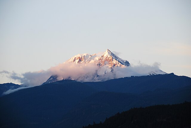
Mount Garibaldi's south face, as seen from Squamish. This is the view George Henry Richards had when he named the peak during the survey in Howe Sound. Garibaldi Park takes its name from this peak.
The Black Tusk, as seen from the trail to Panorama Ridge.
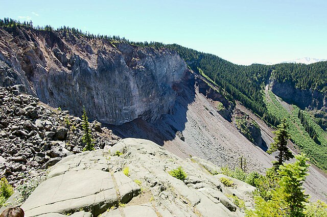
View of The Barrier, which was declared unstable in 1981 and resulted in the evacuation of the village of Garibaldi.
British Columbia Highway 99
Highway 99 is a provincial highway in British Columbia that runs 377 kilometres (234 mi) from the U.S. border to near Cache Creek, serving Greater Vancouver and the Squamish–Lillooet corridor. It is a major north–south artery within Vancouver and connects the city to several suburbs as well as the U.S. border, where it continues south as Interstate 5. The central section of the route, also known as the Sea to Sky Highway, serves the communities of Squamish, Whistler, and Pemberton. Highway 99 continues through Lillooet and ends at a junction with Highway 97 near Cache Creek.
South portal of the George Massey Tunnel, which carries Highway 99 into Richmond
Aerial view of the Lions Gate Bridge, which carries Highway 99 between Vancouver and West Vancouver
Highway 99 north of Squamish