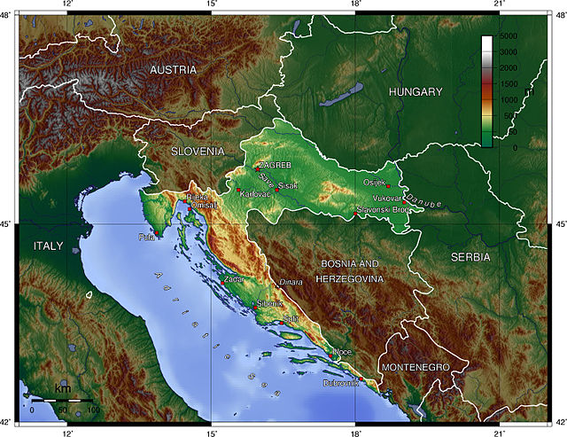
The geography of Croatia is defined by its location—it is described as located at the crossroads of Central Europe and Southeast Europe, a part of the Balkans and Southern Europe. Croatia's territory covers 56,594 km2 (21,851 sq mi), making it the 127th largest country in the world. Bordered by Slovenia in the northwest, Hungary in the northeast, Bosnia and Herzegovina and Serbia in the east, Montenegro in the southeast and the Adriatic Sea in the south, it lies mostly between latitudes 42° and 47° N and longitudes 13° and 20° E. Croatia's territorial waters encompass 18,981 square kilometres (7,329 sq mi) in a 12 nautical miles wide zone, and its internal waters located within the baseline cover an additional 12,498 square kilometres (4,826 sq mi).
Geography of Croatia
Croatian Ecological and Fisheries Protection Zone of the Adriatic Sea
Kornati national park
Dinara seen from Knin
Socialist Republic of Croatia
The Socialist Republic of Croatia, commonly abbreviated as SR Croatia and referred to as simply Croatia, was a constituent republic and federated state of the Socialist Federal Republic of Yugoslavia. By its constitution, modern-day Croatia is its direct continuation.
"All in the fight for the freedom of Croatia", Partisan poster from World War II.
Coat of arms SR Croatia
Vladimir Bakarić, the first head of government of the SR Croatia.
Andrija Hebrang, 4th Secretary of the Communist Party of Croatia, a creator of the Five-Year Plan