Geography of Middle-earth
The geography of Middle-earth encompasses the physical, political, and moral geography of J. R. R. Tolkien's fictional world of Middle-earth, strictly a continent on the planet of Arda but widely taken to mean the physical world, and Eä, all of creation, as well as all of his writings about it. Arda was created as a flat world, incorporating a Western continent, Aman, which became the home of the godlike Valar, as well as Middle-earth. At the end of the First Age, the Western part of Middle-earth, Beleriand, was drowned in the War of Wrath. In the Second Age, a large island, Númenor, was created in the Great Sea, Belegaer, between Aman and Middle-earth; it was destroyed in a cataclysm near the end of the Second Age, in which Arda was remade as a spherical world, and Aman was removed so that Men could not reach it.
Tolkien borrowed the Arthurian place-name Brocéliande for an early version of Beleriand. 1868 illustration by Gustave Doré
John Ronald Reuel Tolkien was an English writer and philologist. He was the author of the high fantasy works The Hobbit and The Lord of the Rings.
Tolkien in the 1920s
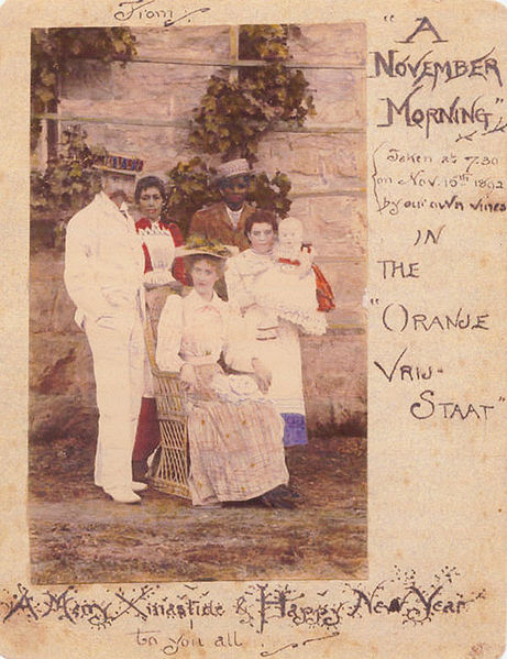
1892 Christmas card with a coloured photo of the Tolkien family in Bloemfontein, sent to relatives in Birmingham, England
Birmingham Oratory, where Tolkien was a parishioner and altar boy (1902–1911)
King Edward's School in Birmingham, where Tolkien was a pupil (1900–1902, 1903–1911)


