Geology of the Bryce Canyon area
The exposed geology of the Bryce Canyon area in Utah shows a record of deposition that covers the last part of the Cretaceous Period and the first half of the Cenozoic era in that part of North America. The ancient depositional environment of the region around what is now Bryce Canyon National Park varied from the warm shallow sea in which the Dakota Sandstone and the Tropic Shale were deposited to the cool streams and lakes that contributed sediment to the colorful Claron Formation that dominates the park's amphitheaters.
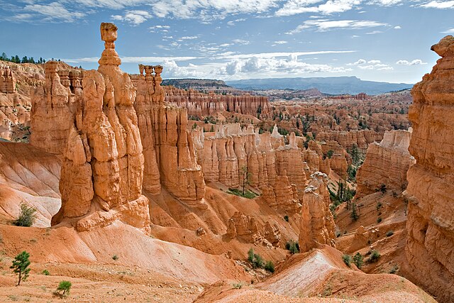
Paria View overlooks an intermittent stream flowing toward the Paria River, some 8 miles (13 km) to the east. About 2 miles (3 km) away is the Paunsaugunt Fault; a normal fault along which the Paria River valley is subsiding on one side while the Paunsaugunt Plateau rises on the other. The pink-colored cliffs, alcoves and amphitheaters along the eroding eastern face of the plateau expose the approximately 50-million-year-old Claron Formation.
Hoodoos in Claron Formation, Bryce Canyon
Bryce Canyon National Park
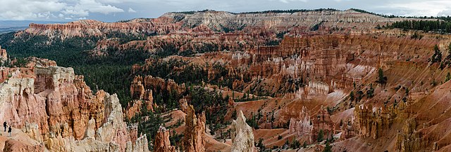
Bryce Canyon National Park is an American national park located in southwestern Utah. The major feature of the park is Bryce Canyon, which despite its name, is not a canyon, but a collection of giant natural amphitheaters along the eastern side of the Paunsaugunt Plateau. Bryce is distinctive due to geological structures called hoodoos, formed by frost weathering and stream erosion of the river and lake bed sedimentary rock. The red, orange, and white colors of the rocks provide spectacular views for park visitors. Bryce Canyon National Park is much smaller and sits at a much higher elevation than nearby Zion National Park. The rim at Bryce varies from 8,000 to 9,000 feet.
Bryce Canyon National Park
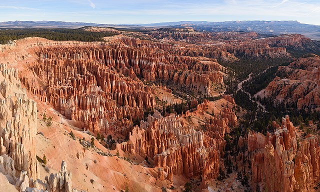
Bryce Amphitheater from Sunrise Point
Ebenezer Bryce and his family lived in this cabin below Bryce Amphitheater (c. 1881).
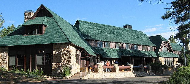
Bryce Canyon Lodge was built between 1924 and 1925 from local materials.