Georgia State Route 28
Videos
Page
State Route 28 (SR 28) is a 25.7-mile-long (41.4 km) state highway in the U.S. state of Georgia. It exists in two distinct segments separated by the northern segment of South Carolina Highway 28 (SC 28), which connects the two segments. The southern segment is entirely within the Augusta metropolitan area. The northern segment is located in the northeastern corner of the Chattooga River District of the Chattahoochee–Oconee National Forest. SR 28 consists of Georgia's segments of a multi-state Route 28 that includes two segments of SC 28 and one segment of North Carolina Highway 28 (NC 28). The northern segment is a south-to-north highway and the roadway it uses is unnamed. However, the southern segment is a west-to-east highway, and the roads it uses are known as Furys Ferry Road from the Furys Ferry Bridge at the South Carolina state line to the intersection with SR 104 Conn. in Augusta, Washington Road in the northern part of Augusta, John C. Calhoun Expressway, Greene Street, 5th Street, and Broad Street in downtown Augusta, and Sand Bar Ferry Road in the northeastern part of Augusta.

Georgia State Route 28 (Greene Street) in Augusta
Augusta metropolitan area
Videos
Page
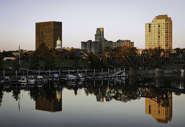
The Augusta metropolitan area, officially the Augusta-Richmond County metropolitan statistical area according to the U.S. Office of Management and Budget, Census Bureau and other agencies, is a metropolitan statistical area centered on the city of Augusta, Georgia. It straddles two U.S. states, Georgia and South Carolina, and includes the Georgia counties of Richmond, Burke, Columbia, Lincoln, and McDuffie as well as the South Carolina counties of Aiken and Edgefield. The official 2023 U.S. census estimate for the area was 629,429 residents, up from 611,000 at the 2020 U.S. census.
Downtown Augusta