The Ghaggar-Hakra River is an intermittent river in India and Pakistan that flows only during the monsoon season. The river is known as Ghaggar before the Ottu barrage at 29.4875°N 74.8925°E, and as Hakra downstream of the barrage in the Thar Desert. In pre-Harappan times the Ghaggar was a tributary of the Sutlej. It is still connected to this paleochannel of the Sutlej, and possibly the Yamuna, which ended in the Nara River, presently a delta channel of the Indus River joining the sea via Sir Creek.
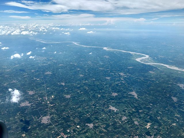
Aerial view of Ghaggar river near Chandigarh
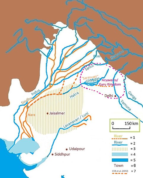
Present-day Gagghar-Hakra river-course, with (pre-)Harappan paleochannel as proposed by Clift et al. (2012). 1 = ancient river 2 = today's river 3 = today's Thar Desert 4 = ancient shore 5 = today's shore 6 = today's town 7 = dried-up Hakra course, and pre-Harappan Sutlej paleochannels (Clift et al. (2012)) See also this satellite image.
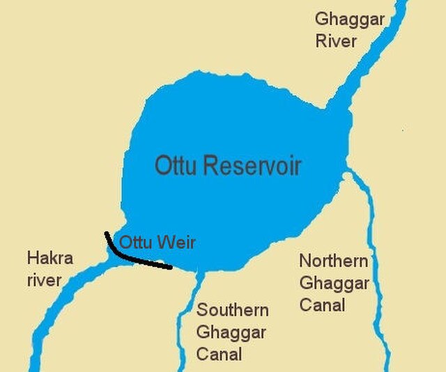
The Ghaggar river flows into the Ottu reservoir, afterwards it becomes the Hakra river
Ghaggar river dry bed in February month near Naurangdesar village, Hanumangarh district, Rajasthan, India.
The wet season is the time of year when most of a region's average annual rainfall occurs. Generally, the season lasts at least one month. The term green season is also sometimes used as a euphemism by tourist authorities. Areas with wet seasons are dispersed across portions of the tropics and subtropics.
A wet-season storm at night in Darwin, Australia
A monsoon in the Vindhya mountain range, central India
Equatorial savanna in the East Province of Cameroon


